
Existed: 1973 – present Constructed 1973 | Length 166.1 km | |
 | ||
Counties | ||
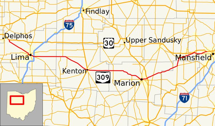
State Route 309 (SR 309) is an east–west highway in central Ohio. Its western terminus is at its interchange with U.S. 30 near Delphos, Ohio, and its eastern terminus is at its interchange with U.S. 30 in Mansfield, Ohio. Its current route takes it through the cities of Lima, Kenton, Marion, Galion, and Ontario; as well as the villages of Elida and Caledonia.
Contents
Map of OH-309, Ohio, USA
History
SR 309's current route was the route of U.S. Route 30S, a divided U.S. route of US 30 until November 1973 when what was US 30N became the mainline of US 30. US 30S was so numbered in the 1920s to avoid conflict from local business owners worried about the diversion of traffic from their shops along the southern route.
The only significant change of the route since this certification is its western terminus, which originally was with U.S. 30 in Delphos. When U.S. 30's bypass around Delphos was completed in 1981, Ohio 309's western terminus was made the easternmost interchange of the bypass.
Before being used as its current route, the route number 309 was used as the route number of what is now State Route 541. It was replaced with the now defunct State Route 271 in 1935.
Harding Highway
The Lincoln Highway left the present State Route 309, a better-quality road at the time, in favor of the direct Delphos-Mansfield route now generally followed by US 30. Only two weeks after the official route was announced in September 1913, it had already been redefined to a straighter path between Lima and Galion; the rest of the straightening came later. The towns along the route got together and formed the Harding Highway, named after President Warren G. Harding, who had grown up in the area.
This Harding Highway continued east via the Lincoln Highway to Canton, turning southeast from there to Steubenville via State Route 43. To the west, it was marked along the Lincoln Highway to Van Wert, heading west along the present U.S. Route 224, roughly State Road 114, State Road 10, State Road 8, and State Road 2 through Indiana to the Illinois state line.