
Existed: 1931 – present Length 16.05 km | Constructed 1931 | |
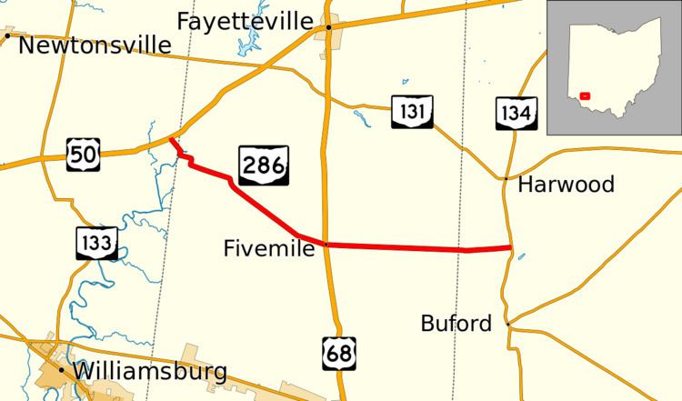 | ||
State Route 286 (SR 286) is a 9.97-mile-long (16.05 km) east–west state highway in the southwestern portion of the U.S. state of Ohio. The western terminus of SR 286 is at U.S. Route 50 (US 50) nearly five miles (8.0 km) southwest of the village of Fayetteville. Its eastern terminus is at SR 134 approximately seven and a quarter miles (11.7 km) northwest of Sardinia.
Contents
Map of OH-286, Ohio, USA
History
The SR 286 designation was applied in 1931. The highway originally ran from its present junction with US 68 (at the time the concurrency of SR 10 and SR 53) to its eastern terminus at SR 134.
In 1938, SR 286 was extended west-northwest along a previously un-numbered roadway to its present western terminus at US 50 southwest of Fayetteville.
References
Ohio State Route 286 Wikipedia(Text) CC BY-SA