
Length 12.96 km | ||
 | ||
Counties | ||
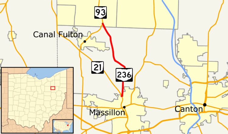
State Route 236 (SR 236, OH 236) is a two-lane north–south state highway in the northeastern portion of the U.S. state of Ohio. Its southern terminus is at a signalized intersection with State Route 21 in the northern end of Massillon. The northern terminus of the route is at a Y-intersection with State Route 93 in New Franklin. The route follows part of the Ohio & Erie Canal Towpath.
Contents
Map of OH-236, Ohio, USA
Route description
State Route 236 traverses portions of northwestern Stark County, namely the city of Massillon as well as Perry, Jackson and Lawrence townships, and New Franklin in southern Summit County. The route is not included as a part of the National Highway System.
History
SR 236 was commissioned in 1924, along current SR 93, between Canal Fulton and its current northern terminus. In 1925 SR 236 was rerouted onto its current alignment from near Crystal Springs to the northern terminus with SR 93. Between 1955 and 1957, the southern terminus was moved, to its current location, in Massillon.