
Existed: 1924 – present Length 29.95 km | Counties: Jefferson Constructed 1924 | |
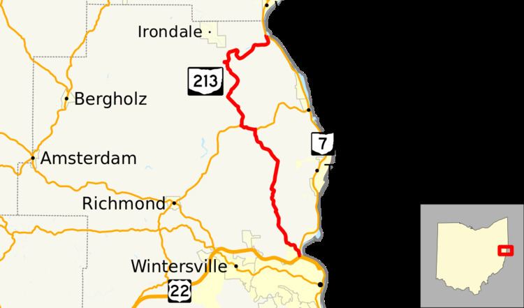 | ||
State Route 213 (SR 213) is a north–south state highway located in the eastern part of the U.S. state of Ohio. The highway's southern terminus is at an interchange that doubles as the northern split of the concurrency of U.S. Route 22 and State Route 7 just north of the city limits of Steubenville. State Route 213's northern terminus is also at State Route 7, this time approximately 1 mile (1.6 km) south of the village of Wellsville, Ohio.
Contents
Map of OH-213, Ohio, USA
Route description
All of State Route 213 is nestled within the northeastern quadrant of Jefferson County. There is no portion of this highway that is included as a part of the National Highway System.
History
SR 213 was designated in 1924, routed along the same alignment within Jefferson County that it maintains at this point in history. No major changes have taken place to the highway's routing since it was established.
Major intersections
The entire route is in Jefferson County.