
Existed: 1923 – present Length 26.76 km | Constructed 1923 | |
 | ||
Counties | ||
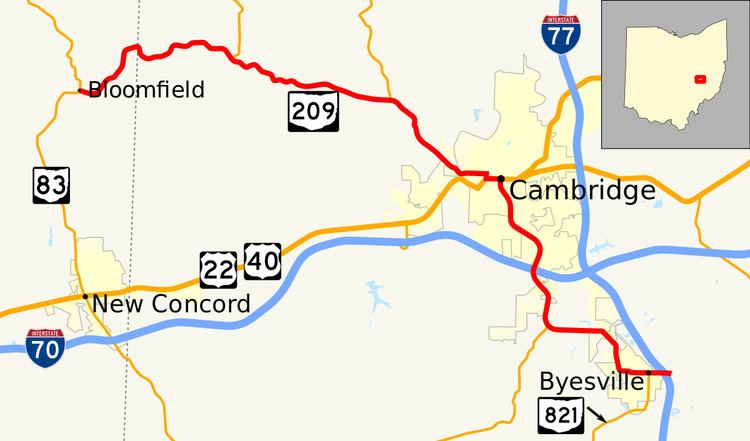
State Route 209 (SR 209, OH 209) is an east–west state highway in eastern Ohio, a U.S. state. The western terminus of State Route 209 is at a T-intersection with State Route 83 approximately 3.75 miles (6.04 km) north of New Concord. State Route 209's eastern terminus is concurrent with the northern terminus of State Route 821 at Interstate 77 at its exit 41 in Byesville, just 2.25 miles (3.62 km) southeast of the Interstate's interchange with Interstate 70.
Contents
Map of OH-209, Ohio, USA
Route description
State Route 209 traverses a small portion of northeastern Muskingum County and a good part of the western half of Guernsey County. No segment of this highway is included within the National Highway System, a network of routes deemed to be most important for the nation's economy, mobility and defense.
History
When it was first designated in 1923, State Route 209 ran along its present alignment from its current western terminus at what was then designated State Route 76 (now State Route 83) north of New Concord to downtown Cambridge. By 1959, with the transferring of U.S. Route 21 onto a new alignment from Byesville north that passes to the east of Cambridge along what is now the alignment of Interstate 77, State Route 209 was extended southeasterly from Cambridge to its present eastern terminus in Byesville along the former alignment of U.S. Route 21.