
Max. depth 8 m (26 ft) | ||
 | ||
Primary inflows Similar Ikogosi Warm Springs, Yankari National Park, Ogbunike Caves, Olumo Rock, Gurara Waterfalls | ||
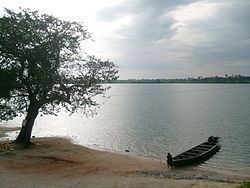
Family boat ride at oguta lake
Oguta Lake is a lean 'finger lake' formed by the damming of the lower Njaba River with alluvium. It is the largest natural lake in Imo State, Southeastern Nigeria; within the equatorial rainforest region of Niger Delta. Oguta Lake's catchment area comprises the drainage area of the Njaba River and a part of the River Niger floodplain in the region south of Onitsha.
Contents
- Family boat ride at oguta lake
- Map of Oguta Lake Nigeria
- Oguta lake
- Location
- Economic Importance
- Trade Route
- References
Map of Oguta Lake, Nigeria
Oguta lake
Location
The lake is situated in Oguta about thirty miles (48.27 km) from the junction of the Ndoni and Orashi River.It is a fine piece of water, being about five miles (8.05 km) long from east to west and a mile and half (2.41 km) wide. The stream from Njaba River is the major inflow to Oguta Lake. The other 3 tributaries are Awbana, Utu and Orashi. The Orashi River flows past Oguta Lake in its southwestern portion.
Economic Importance
The lake is important to the people of oil-rich Njaba River basin including Oguta, Orsu, Mgbidi, Nkwesi, Osemotor, Awo-Omamma and Izombe as a source of water, fish, tourism and an outlet for sewerage. Uhamiri is the goddess of the Lake.
Trade Route
The river route Njaba and Orashi via Oguta Lake to the coast, passing through Awo-omamma, Mgbidi, Oguta, Ndoni, Abonnema, made Oguta, Osemotor, Awo-omamma and surrounding towns important commercial centres of international trade mainly for oil palm. Oguta Lake also served as a Biafran army marine base during the Nigerian Civil War.