
Length 55 km Country United States of America | Basin area 382 km² | |
 | ||
Basin size 94,394 acres (382.00 km) Tributaries Left:Silver Creek, Little Ocqueoc River, Indian Creek Bridges Ocqueoc Falls Highway-Ocqueoc River Bridge | ||
The Ocqueoc River (pronounced Ah-key-ock) is stream in Presque Isle County in the northeastern part of the lower peninsula in the U.S. state of Michigan. It is 34.2 miles (55.0 km) long and encompasses a watershed of approximately 94,394 acres (382.00 km2).
Contents
- Map of Ocqueoc River Ocqueoc Township MI USA
- Snowshoeing ocqueoc river
- Description and courseEdit
- Drainage basinEdit
- Named tributariesEdit
- References
Map of Ocqueoc River, Ocqueoc Township, MI, USA
The word Ocqueoc comes from a French term meaning "crooked waters", which aptly describes the winding Ocqueoc River.
Snowshoeing ocqueoc river
Description and courseEdit
The Ocqueoc River is the largest river entirely within Presque Isle County and drains several lakes, including Ocqueoc Lake, and receives a few tributaries, the largest being the Little Ocqueoc River and Silver Creek. The Ocqueoc River's source is in southern Bismarck Township at 45°13′15″N 83°55′45″W approximately 10 miles (16 km) southeast of the village of Millersburg, which with a population 263 people at the 2000 Census is the largest community in the watershed.
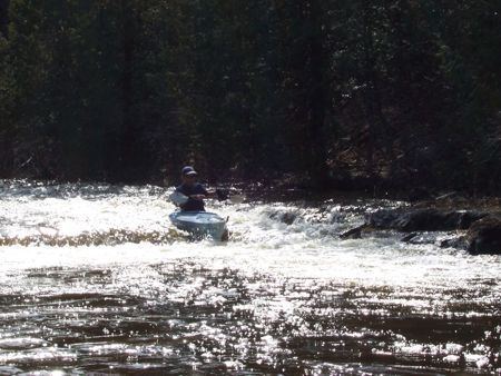
Ocqueoc Falls are the largest waterfalls in the Lower Peninsula of Michigan with a drop of about 5 feet (1.5 m). The falls and the Ocqueoc Falls Bicentennial Pathway, which offers groomed winter trails and summer hiking trails, are a tourist attraction of Presque Isle County. The Ocqueoc River is one of the few rivers in the Lower Peninsula to flow north.
The Ocqueoc River flows through a limestone karst region, and some of its tributaries, notably the Little Ocqueoc, are not continuous on the surface but flow through subterranean systems for part of their course. The upper reaches of the river's watershed is swampy with cedar, tamarack, balsam, poplar, aspen and black ash common. The warmer upper ranges have more warm-water fish including sunfish, pike and bass, while the lower cooler part of the river has salmon and trout. Smelt dipping is a style of fishing used near the mouth of the Ocqueoc.
Drainage basinEdit
The Ocqueoc River drainage basin includes all or portions of the following townships and municipalities in Presque Isle County:
Bismarck Township
A very small portion of the watershed is located in northern Montmorency County but contains no surface water.
Named tributariesEdit
Named waterbodies with direct surface flow into the Ocqueoc River system, from the mouth: