
Founded 1881 | Area 1,458 km² Population 9,350 (2013) Unemployment rate 9.6% (Apr 2015) | |
 | ||
Website www.montmorencycountymichigan.us Destinations | ||
Montmorency County is a county located in the U.S. state of Michigan. As of the 2010 census, the population was 9,765. The county seat is Atlanta.
Contents
- Map of Montmorency County MI USA
- History
- Geography
- Adjacent counties
- Major highways
- Demographics
- Economy
- Government
- Elected officials
- Recreation
- Media
- Endangered species
- Village
- Census designated places
- Townships
- References
Map of Montmorency County, MI, USA
History
The county was created by the Michigan Legislature in 1840 as Cheonoquet County, after a well known Chippewa (also known as Ojibwa) Chief, whose name meant Big Cloud. Cheonoquet took part in Indian treaties in 1807, 1815, 1825 and 1837. Renamed Montmorency County on March 8, 1843, it was originally spelled Montmorenci, and historians conjecture this reflects the area's French-Canadian influence: the French Duke of Montmorency purchased a lieutenant governorship in Canada and the first archbishop of Canada--Montmorency-Laval--both could be influences on the county's name. (There was no "Count Morenci" aiding the American Revolution). The county was organized in 1881. The reason for the change in spelling is subject to some dispute. See List of Michigan county name etymologies. The name Montmorency probably means Mountain Moor. Montmorency is very much a boggy land or moor that is at the top of a broad mount or highland. When the county was formed in 1881, some land area was taken from Cheboygan and Alpena counties. Three townships were divided, namely Briley, Montmorency and Rust. By 1901 Albert, Hillman and Wheatfield were added. Brush Creek, now known as Hillman, was the first county seat. In 1891 the county seat was moved to Atlanta.
Geography
According to the U.S. Census Bureau, the county has a total area of 563 square miles (1,460 km2), of which 547 square miles (1,420 km2) is land and 16 square miles (41 km2) (2.8%) is water. The county is considered to be part of Northern Michigan.
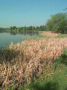
Most of the county is covered by state forest land. There is and has been an abundance of lakes. Glaciers shaped the area, creating a unique regional ecosystem. A large portion of the area is the so-called Grayling outwash plain, which consists of broad outwash plain including sandy ice-disintegration ridges; jack pine barrens, some white pine-red pine forest, and northern hardwood forest. Large lakes were created by glacial action.
Adjacent counties
Major highways
Bus. M‑32
There are no traffic lights in Montmorency county, a few blinking lights are scattered about at highway junctions.
Demographics
As of the census of 2000, there were 10,315 people, 4,455 households, and 3,047 families residing in the county. The population density was 19 people per square mile (7/km²). There were 9,238 housing units at an average density of 17 per square mile (7/km²). The ethnic makeup of the county was 98.36% White, 0.24% Black or African American, 0.36% Native American, 0.10% Asian, 0.10% from other races, and 0.84% from two or more ethnic groups. 0.65% of the population were Hispanic or Latino of any ethnic group. 28.3% were of German, 12.7% English, 9.5% American, 8.8% Irish, 7.6% Polish and 7.4% French ancestry according to Census 2000. 98.1% spoke English as their first language.
There were 4,455 households out of which 22.50% had children under the age of 18 living with them, 58.10% were married couples living together, 7.10% had a female householder with no husband present, and 31.60% were non-families. 27.50% of all households were made up of individuals and 15.40% had someone living alone who was 65 years of age or older. The average household size was 2.29 and the average family size was 2.75.
In the county, the population was spread out with 20.30% under the age of 18, 5.90% from 18 to 24, 20.90% from 25 to 44, 29.10% from 45 to 64, and 23.90% who were 65 years of age or older. The median age was 47 years. For every 100 females there were 96.60 males. For every 100 females age 18 and over, there were 94.90 males.
The median income for a household in the county was $30,005, and the median income for a family was $34,784. Males had a median income of $30,910 versus $19,299 for females. The per capita income for the county was $16,493. About 9.80% of families and 12.80% of the population were below the poverty line, including 20.00% of those under age 18 and 8.70% of those age 65 or over.
Economy
Dairy products and dry beans are an important part of the county's agricultural production. Service industry and retail trade relating to tourism make up most of the economic base in this rural area. Boating, fishing, and other outdoor activities are offered in abundance.
Government
The county government operates the jail, maintains rural roads, operates the major local courts, keeps files of deeds and mortgages, maintains vital records, administers public health regulations, and participates with the state in the provision of welfare and other social services. The county board of commissioners controls the budget but has only limited authority to make laws or ordinances. In Michigan, most local government functions — police and fire, building and zoning, tax assessment, street maintenance, etc. — are the responsibility of individual cities and townships.
Elected officials
(information as of August 2008)
Recreation
ORV/ATV and snowmobile trails are considered some of the best in the state of Michigan, many areas are designated as "trail mazes" on some maps. Montmorency county is one of a few counties that allow ATVs on public county roads, thus creating access for fuel, food and various hotels to Hillman, Atlanta, and Lewiston. The main trail system incorporates a scenic Elk tour and various levels of ATV trails.
Media
Endangered species
Montmorency County is home to Michigan's most endangered species and one of the most endangered species in the world: the Hungerford's crawling water beetle. The species lives in only five locations in the world, two of which are in Montmorency County, both inside the Mackinaw State Forest. The first site is along the East Branch of the Black River where two adult beetles were found in surveys in 1989 and two more again in 1996. In July 1999, six additional adult beetles were identified in the county living in Van Hetton Creek. This latter find was significant as it represented a new location beyond those originally identified when the Hungerford's crawling water beetle was categorized as endangered on March 7, 1994, under the provisions of the U.S. Endangered Species Act. The Van Hetton Creek sighting therefore provides the possibility that more of these very rare beetles might be found elsewhere in Montmorency County.