
Admin. region Oberbayern Municipal assoc. Oberding Area 64.7 km² Population 5,380 (31 Dec 2008) Dialling code 08122 | Elevation 468 m (1,535 ft) Local time Wednesday 3:13 AM Postal code 85445 | |
 | ||
Weather 6°C, Wind N at 8 km/h, 89% Humidity | ||
Sks gmbh autorisierter 3m premiumpartner der industrie in oberding m nchen imagefilm
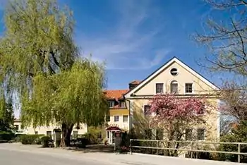
Oberding (German: Oberding, Bavarian: Obading) is a municipality in the district of Erding in Upper Bavaria in Germany, and member of the same administrative community. Almost half of the area of Munich Airport, with both terminals, falls within the municipal bounds.
Contents
- Sks gmbh autorisierter 3m premiumpartner der industrie in oberding m nchen imagefilm
- Map of Oberding Germany
- Bulldog und bremswagenfreunde notzing oberding ortschaft der woche
- Geography
- Districts
- Other parts of municipalities
- Waters
- History
- Population Development
- Policy
- Coat of arms and flag
- Economy agriculture and forestry
- Education
- Attractions
- References
Map of Oberding, Germany
Bulldog und bremswagenfreunde notzing oberding ortschaft der woche
Geography
Oberding is located in the Munich area in the middle of Erdinger Moos between the rivers Sempt and village. The village is located about 6 km north-west of the county Erding, 17 km south of Freising and 36 km from the state capital Munich in the immediate vicinity of the Munich Airport.
Districts
Other parts of municipalities
For the construction of the Munich Airport landing paths of in 1992, the residents of Franz home were partially displaced by Schwaiger Moos. Much of the current airport site, including the terminals is located in the municipality. For the planned construction of the third take-off and landing strip another partial removal of moss Schwaiger is necessary.
Waters
The Middle-Isar-channel and the river village, both flow in roughly a north-south direction.
History
The region was part of the Electorate Bavaria, forming a closed Hofmark of cathedrals of Bishopric of Freising, with the Bishopric in 1803 deleted. In the course of administrative reform, the Bavaria was given the Community Edict of 1818 by the church.
Population Development
The region population in 1970 was 3,111, in 1987 3,229 and in 2000 4,692.
Policy
Mayor Helmut Lackner (Gem.Wahlvorschl. Ud CSU voters).
The municipal tax revenue in 1999 amounted to the equivalent of €6166 € T, which amounted to the business tax receipts (net) 3458 T converted.
Coat of arms and flag
The coat of arms established on 25 May 1950 is "in blue at an angle on the left posed silver scythe." Besides the coat of arms, the town flag are the colors blue, white and blue.
Economy, agriculture and forestry
The largest contribution to the municipality is the Munich Airport Franz Josef Strauss, which opened in 1992, it is the most important economic factor; also in the district is the power station Santa Maria on the Middle-Isar-channel.
The official 1998 statistics:
Also, in 1999 there were 121 agricultural holdings with a utilized agricultural area of 3,619 ha, of which 3,033 ha is arable land.
Education
In 1999, there were the following facilities: