
Website nyeri.go.ke Population 693,558 (2009) | Formed March 4th 2013 Time zone EAT (UTC+3) Area 2,361 km² | |
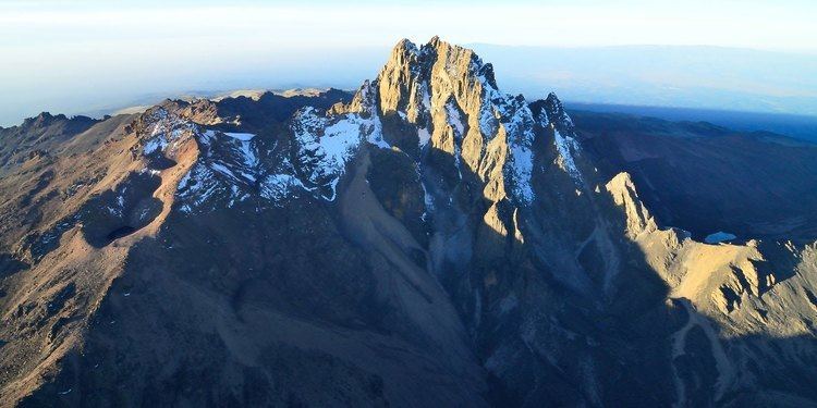 | ||
Colleges and Universities Dedan Kimathi University, Karatina University, Kagumo College Points of interest Mount Kenya, Chaka Ranch, Baden‑Powell Museum, Chania Falls, Mount Satima | ||
The maina kageni roadtrip tour nyeri county
Nyeri County is located in the central region of Kenya. Its capital and largest town is Nyeri. It has a population of 661,156 and an area of 3,356 km².
Contents
- The maina kageni roadtrip tour nyeri county
- Map of Nyeri County Kenya
- Samuel wamathai speech nyeri county ministers prepare for the worst as county get new governor
- People
- Constituencies
- Urbanisation
- WealthPoverty Level
- References
Map of Nyeri County, Kenya
Samuel wamathai speech nyeri county ministers prepare for the worst as county get new governor
People
The county is located on the southwest flank of Mount Kenya. Local people are predominantly of the Kikuyu ethnicity.
Constituencies
The county has six constituencies:
Urbanisation
Source: OpenDataKenya
Wealth/Poverty Level
Source: OpenDataKenya Worldbank
References
Nyeri County Wikipedia(Text) CC BY-SA