
Coat of arms Flag Administrative center selo of Krasnaya Gorka Rural localities 51 | Country Russia Selsoviets 12 Area 2,236 km² | |
 | ||
Federal subject Republic of Bashkortostan | ||
Holiday russia bashkortostan nurimanovsky district sabantuy of 2016 6
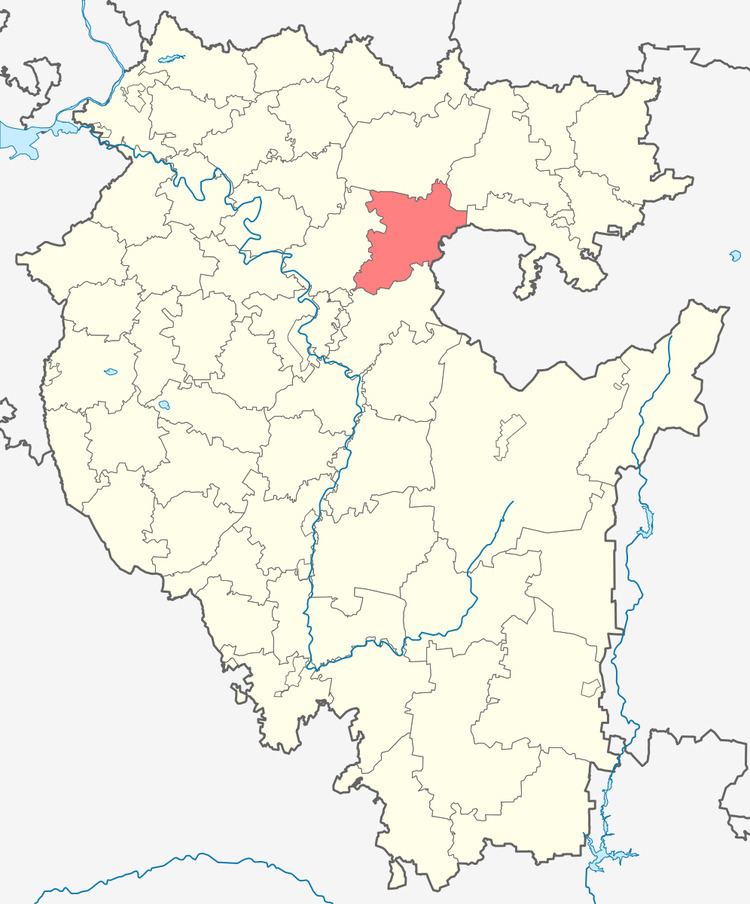
Nurimanovsky District (Russian: Нурима́новский райо́н; Bashkir: Нуриман районы) is an administrative and municipal district (raion), one of the fifty-four in the Republic of Bashkortostan, Russia. It is located in the northeast of the republic and borders with Karaidelsky District in the north, Chelyabinsk Oblast in the east, Iglinsky District in the south, and with Blagoveshchensky District in the west. The area of the district is 2,634 square kilometers (1,017 sq mi). Its administrative center is the rural locality (a selo) of Krasnaya Gorka. As of the 2010 Census, the total population of the district was 20,824, with the population of Krasnaya Gorka accounting for 20.6% of that number.
Contents
- Holiday russia bashkortostan nurimanovsky district sabantuy of 2016 6
- Map of Nurimanovsky District Republic of Bashkortostan Russia
- Holiday russia bashkortostan nurimanovsky district sabantuy of 2016 10
- History
- Administrative and municipal status
- References
Map of Nurimanovsky District, Republic of Bashkortostan, Russia
Holiday russia bashkortostan nurimanovsky district sabantuy of 2016 10
History
The district was established in 1930.
Administrative and municipal status
Within the framework of administrative divisions, Nurimanovsky District is one of the fifty-four in the Republic of Bashkortostan. The district is divided into twelve selsoviets, comprising fifty-one rural localities. As a municipal division, the district is incorporated as Nurimanovsky Municipal District. Its twelve selsoviets are incorporated as twelve rural settlements within the municipal district. The selo of Krasnaya Gorka serves as the administrative center of both the administrative and municipal district.