
Population 4,768 (2011 census) Postcode(s) 3636 Founded 1868 Local time Tuesday 2:34 PM | Established 1868 Elevation 108 m Postal code 3636 Federal division Division of Murray | |
 | ||
Weather 26°C, Wind N at 14 km/h, 66% Humidity | ||
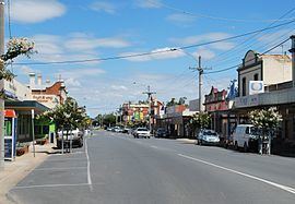
Numurkah (/njuːˈmɜːrkə/ or locally [njʉːˈmɜːkə] new-MUR-kə) is a town in Victoria, Australia, located on the Goulburn Valley Highway, 37 kilometres (23 mi) north of Shepparton, in the Shire of Moira. At the 2011 census, Numurkah had a population of 4,768.
Contents
- Map of Numurkah VIC 3636 Australia
- History
- Recreation
- Biodiversity and natural features
- Natural Disasters
- References
Map of Numurkah VIC 3636, Australia
History
The area was occupied by the Yorta Yorta people prior to European settlement. Squatters moved into the area from NSW in the late 1830s. After the pastoral runs were made available for farm selection, the township of Numurkah was surveyed in 1875, the Post Office opening 2 November 1878. The local railway station was opened on the Goulburn Valley railway in 1881, but has not seen any passenger services since 1993 when the train to Cobram was withdrawn. The station building remains in private ownership, and a footbridge crosses the line.
The name is thought to be derived from an Aboriginal word meaning war shield, although a recent authority thinks that this is mistaken. The town hosts an art show in March, a fishing competition in April, and go-kart championships in September and a car show in December.
Recreation
The town has an Australian rules football team competing in the Murray Football League.
Golfers play at the course of the Numurkah Golf Club on Tunnock Road.
Other popular sports include: Numurkah Lawn Tennis Club, Lawn Bowls, Soccer, Gymnasium & an Outdoor Swimming Pool which is operated during the warmer months.
Biodiversity and natural features
Numurkah is a low lying town located on the floodplain of the Broken Creek. The Broken Creek flows into the Murray River just north of the township of Barmah. The riparian area adjacent to the creek has a dominant over-storey of Eucalyptus camaldulensis (Red Gum). Above the floodplain tree species include Eucalyptus microcarpa (Grey Box), Eucalyptus melliodora (Yellow Box) and Callitris glaucophylla (Murray Pine). There is a small roosting population of Grey-headed flying foxes (Pteropus poliocephalus)and Little Red flying foxes (Pteropus Scapulatus). These mega-bats are important pollinators of native tree species. Their diet is nectar, pollen, and fruit. The Little Red flying fox has translucent wings and eats nectar from flowers almost exclusively. Both have long tongues for getting deep into flowers. Numurkah also is home to many species of insect eating microbats (small bats) with the Goulds Wattled Bat being the most common. These small bats live in tree hollows and play an important role in insect control eating large quantities of insects each night.
Natural Disasters
In 2012 Numurkah had some devastating floods which saw a large portion of the town flood including the local hospital which was demolished as a result.