
Sub-region Rwenzori sub-region Time zone EAT (UTC+3) Elevation 640 m | Website www.ntoroko.go.ug Area 1,254 km² | |
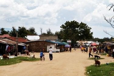 | ||
Ntoroko District is a district in the Western Region of Uganda. The district headquarters are in the Kibuuku town council.
Contents
Map of Ntoroko, Uganda
Location
Ntoroko District is one of the two Ugandan districts west of the Rwenzori Mountains, the other being Bundibugyo District. The Ntoroko District is bordered by the Democratic Republic of the Congo to the west and north, Hoima District to the north-east, Kibaale District to the east, Kabarole District to the south, and Bundibugyo District to the south-west. The town of Ntoroko is approximately 132 kilometres (82 mi), by road, north-east of Kasese, the largest town in the Rwenzururu sub-region This location is approximately 300 kilometres (190 mi), by road, west of Kampala, the capital and largest city of Uganda. The coordinates of the district are 01 06N, 30 24E.
Overview
The Ntoroko District was created by the Ugandan Parliament and became operational on 1 July 2010. Before that, the district was part of the Bundibugyo District. The district is part of the Rwenzururu sub-region, which is coterminous with the Rwenzururu Kingdom.
Population
In 1991, the national population census estimated the district population at 24,300. The national census in 2002 estimated the population at 51,100. In 2012, the population was estimated at 84,100.