
Formed January 1, 1999 Postal Code N0H Population 3,744 (2011) | Time zone EST (UTC-5) Area code(s) 519 and 226 | |
 | ||
70 stokes river rd northern bruce peninsula ontario presented by sharon j crann amp robert m d
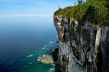
The Municipality of Northern Bruce Peninsula is located on the Bruce Peninsula in Bruce County, Ontario, Canada. It is a popular vacation spot in the summer for its water sports and cottaging, and in the winter for snowmobiling. The municipality was formed on January 1, 1999, when the townships of St. Edmunds, Lindsay, and Eastnor (which was named after Eastnor, Herefordshire), as well as the Village of Lion's Head, were amalgamated.
Contents
- 70 stokes river rd northern bruce peninsula ontario presented by sharon j crann amp robert m d
- Map of Northern Bruce Peninsula ON Canada
- Communities
- Demographics
- References
Map of Northern Bruce Peninsula, ON, Canada
It is home to the Bruce Peninsula National Park, the Fathom Five National Marine Park, and the Lion's Head Provincial Park.
Communities
Its main population centres are Lion's Head and Tobermory. Other communities include Barrow Bay, Clarke's Corners, Dyer's Bay, Ferndale, Hope Bay, Miller Lake, Pike Bay, and Stokes Bay.
Demographics
Population trend: