
Length 79 mi (127 km) Lowest point Swiftwater Trailhead | Elevation change 4,200 ft (1,300 m) | |
 | ||
Trailheads SwiftwaterWright CreekMottPantherCalfMarstersSoda SpringsToketee LakeHot SpringsWhite MuleKelsay ValleyDigit Point Uses Hiking, Equestrianism, Mountain biking | ||
North umpqua trail nut mountain biking
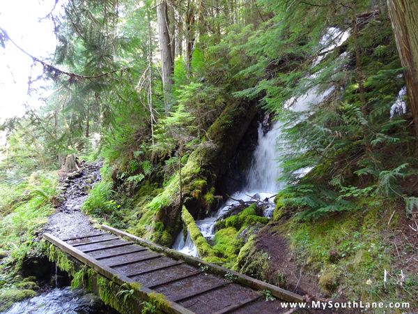
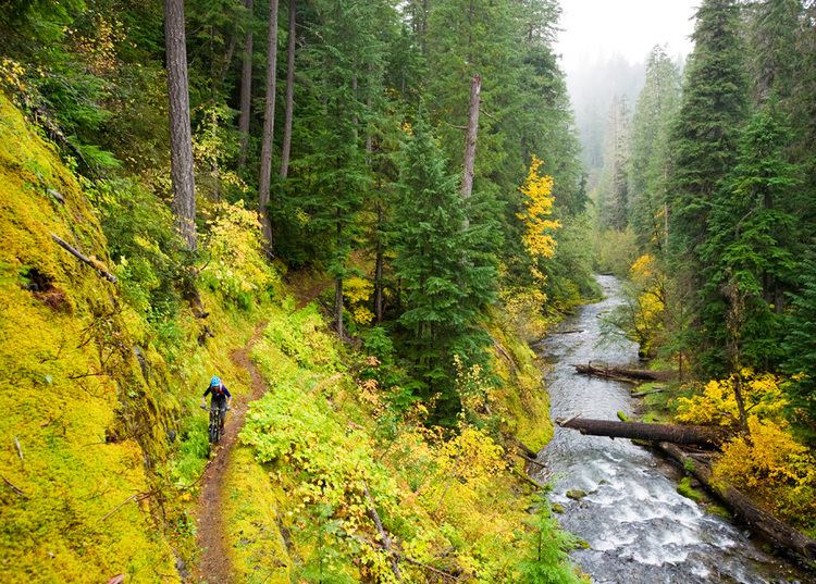
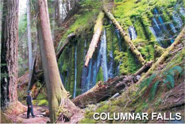
The North Umpqua Trail is a multi-use trail open for hiking, mountain biking and horse-back riding that follows the North Umpqua River in Southern Oregon, United States. The trail is about 79 miles (127 km) long. It is broken up into 11 sections, ranging from 3.5 to 15.7 miles (25.3 km) in length. The trail ranges in elevation from 800 feet (240 m) to about 6,000 feet (1,800 m).
Contents
- North umpqua trail nut mountain biking
- Mountain biking north umpqua trail oregon w gopro
- Route
- References
Mountain biking north umpqua trail oregon w gopro
Route
The North Umpqua Trail follows the North Umpqua River as it winds west out of the Cascades and towards the city of Roseburg, Oregon. The trail is inside the Umpqua National Forest and closely follows the river most for most of its length. The trail almost completely avoids all human structures, except at one of the trailheads.


References
North Umpqua Trail Wikipedia(Text) CC BY-SA