
Founded January 7, 1852 Website www.co.douglas.or.us Population 106,940 (2013) Unemployment rate 7.2% (Apr 2015) | Area 13,297 km² | |
 | ||
Rivers Rogue River, Pass Creek, Steamboat Creek Destinations | ||
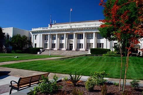
Roseburg city councilor douglas county oregon drought june 2015
Douglas County is a county in the U.S. state of Oregon. As of the 2010 census, the population was 107,667. The county seat is Roseburg. It is named after Stephen A. Douglas, an American politician who supported Oregon statehood.
Contents
- Roseburg city councilor douglas county oregon drought june 2015
- Map of Douglas County OR USA
- History
- Geography
- National protected areas
- Adjacent counties
- 2000 census
- 2010 census
- Economy
- Media
- References
Map of Douglas County, OR, USA
Douglas County comprises the Roseburg, OR Micropolitan Statistical Area.
History
The area originally was inhabited by the Umpqua Indians, who speak a language in the Athabaskan language family (although some linguists put it in the Penutian family). Following the Rogue River Indian War in 1856, most of the remaining natives were moved by the government to the Grand Ronde Indian Reservation. However, seven families of Umpqua hid in the hills, eluding capture for many decades. They are now federally recognized as the Cow Creek Band of Umpqua Tribe of Indians. The tribe manages a small reservation in Canyonville, Oregon, and has a Casino/Hotel named Seven Feathers to represent the seven families who refused forced removal to the Grand Ronde Reservation.
Douglas County was created on January 7, 1852, from the portion of Umpqua County which lay east of the Coast Range summit. In 1856 the Camas Valley was annexed to Douglas County from Coos County. In 1862, the rest of Umpqua county was absorbed into Douglas County, some say due to the loss of population following the end of the early gold boom, while others attribute the absorption to politics. Further boundary adjustments were made with Jackson and Lane Counties in 1915.
Geography
According to the U.S. Census Bureau, the county has a total area of 5,134 square miles (13,300 km2), of which 5,036 square miles (13,040 km2) is land and 98 square miles (250 km2) (1.9%) is water. It is the fifth-largest county in Oregon by area. A portion of the Umpqua National Forest is in Douglas County. Douglas County is one of two Oregon counties that extend from the Pacific Ocean to the Cascade Range. (The other is Lane County.)
National protected areas
Adjacent counties
2000 census
As of the census of 2000, there were 100,399 people, 39,821 households, and 28,233 families residing in the county. The population density was 20 people per square mile (8/km²). There were 43,284 housing units at an average density of 9 per square mile (3/km²). The racial makeup of the county was 93.86% White, 0.18% Black or African American, 1.52% Native American, 0.63% Asian, 0.09% Pacific Islander, 1.02% from other races, and 2.70% from two or more races. 3.27% of the population were Hispanic or Latino of any race. 18.4% were of German, 13.2% American, 12.6% English and 10.2% Irish ancestry. 96.5% spoke English and 2.2% Spanish as their first language.
There were 39,821 households out of which 29.10% had children under the age of 18 living with them, 57.2% were married couples living together, 9.6% had a female householder with no husband present, and 29.1% were non-families. 23.9% of all households were made up of individuals and 11% had someone living alone who was 65 years of age or older. The average household size was 2.48 and the average family size was 2.9.
In the county, the population was spread out with 24% under the age of 18, 7.5% from 18 to 24, 24.2% from 25 to 44, 26.4% from 45 to 64, and 17.8% who were 65 years of age or older. The median age was 41 years. For every 100 females there were 96.8 males. For every 100 females age 18 and over, there were 94.2 males.
The median income for a household in the county was $33,223, and the median income for a family was $39,364. Males had a median income of $32,512 versus $22,349 for females. The per capita income for the county was $16,581. About 9.6% of families and 13.1% of the population were below the poverty line, including 16.6% of those under age 18 and 9.2% of those age 65 or over.
2010 census
As of the 2010 United States Census, there were 107,667 people, 44,581 households, and 29,839 families residing in the county. The population density was 21.4 inhabitants per square mile (8.3/km2). There were 48,915 housing units at an average density of 9.7 per square mile (3.7/km2). The racial makeup of the county was 92.4% white, 1.8% American Indian, 1.0% Asian, 0.3% black or African American, 0.1% Pacific islander, 1.2% from other races, and 3.2% from two or more races. Those of Hispanic or Latino origin made up 4.7% of the population. In terms of ancestry, 25.6% were German, 16.7% were Irish, 15.8% were English, and 5.7% were American.
Of the 44,581 households, 26.4% had children under the age of 18 living with them, 51.2% were married couples living together, 10.8% had a female householder with no husband present, 33.1% were non-families, and 26.6% of all households were made up of individuals. The average household size was 2.38 and the average family size was 2.82. The median age was 46.1 years.
The median income for a household in the county was $39,711 and the median income for a family was $48,729. Males had a median income of $39,308 versus $28,176 for females. The per capita income for the county was $21,342. About 10.6% of families and 15.6% of the population were below the poverty line, including 24.1% of those under age 18 and 9.0% of those age 65 or over.
Economy
The entire watershed of the Umpqua River lies within the boundaries of Douglas County. The heavily timbered county contains nearly 1.8 million acres (7,300 km2) of commercial forest lands and one of the oldest stands of old growth timber in the world. Approximately 25–30% of the labor force is employed in the forest products industry. Agriculture, mainly field crops, orchards, and livestock (particularly sheep ranching), is also important to the economy of the county. The land of Douglas County is roughly half-publicly and half-privately owned.
The post-Prohibition wine industry in Oregon began with Richard Somer planting Hillcrest Vineyard at the south end of the Umpqua Valley in 1961. The Umpqua Valley wine appellation lies entirely within Douglas county.
Nickel has been refined at Riddle since 1954. There is a significant federal presence in the region; the Forest Service and Bureau of Land Management administer more than 50% of the county's land.
As of 2015, the top ten private employers in the county were: