
Country United States Incorporated October 10, 1982 Population 242 (2013) Local time Tuesday 7:54 PM | State Alaska Elevation 56 ft (17 m) Area code 907 Zip code 99791 | |
 | ||
Weather -32°C, Wind W at 24 km/h, 75% Humidity Borough | ||
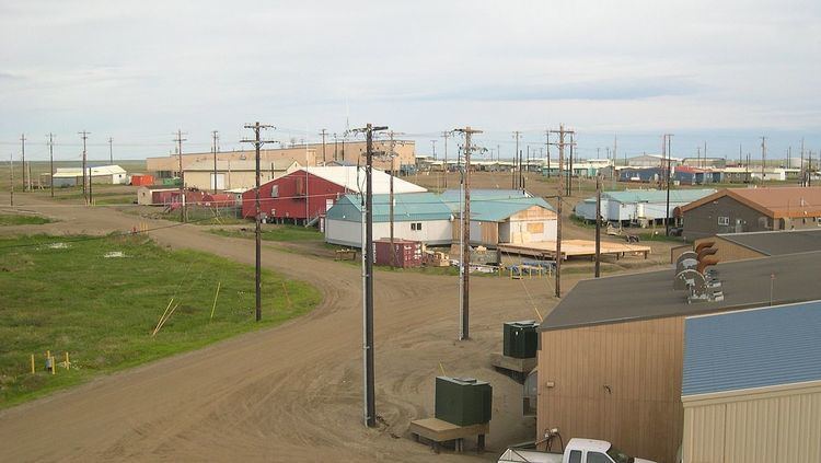
Atqasuk ([ɐtqɐsuk]) is a city in North Slope Borough, Alaska, United States. The population was 228 at the 2000 census and 233 as of the 2010 census.
Contents
Map of Atqasuk, AK 99791, USA
Geography
Atqasuk is located at 70°28′40″N 157°25′05″W (70.477663, -157.418056).
According to the United States Census Bureau, the city has a total area of 42.3 square miles (110 km2), of which 38.9 square miles (101 km2) is land and 3.5 square miles (9.1 km2) (8.22%) is water.
Atqasuk has one airport, Atqasuk Edward Burnell Sr. Memorial Airport, that is uncontrolled and has a single 4,370-by-90-foot (1,332 by 27 m) runway at an elevation of 96 feet (29 m).
Demographics
As of the 2010 United States Census, there were 233 people residing in the city. The racial makeup of the city was 92.3% Native American, 6.9% Black and 0.9% from two or more races.
As of the census of 2000, there were 228 people, 55 households, and 44 families residing in the city. The population density was 5.9 people per square mile (2.3/km²). There were 60 housing units at an average density of 1.5 per square mile (0.6/km²). The racial makeup of the city was 4.82% White, 94.30% Native Alaskan, 0.44% Asian, and 0.44% from two or more races.
There were 55 households out of which 50.9% had children under the age of 18 living with them, 47.3% were married couples living together, 21.8% had a female householder with no husband present, and 18.2% were non-families. 16.4% of all households were made up of individuals and none had someone living alone who was 65 years of age or older. The average household size was 4.15 and the average family size was 4.49.
In the city, the age distribution of the population shows 40.4% under the age of 18, 8.8% from 18 to 24, 29.8% from 25 to 44, 15.4% from 45 to 64, and 5.7% who were 65 years of age or older. The median age was 26 years. For every 100 females there were 113.1 males. For every 100 females age 18 and over, there were 123.0 males.
The median income for a household in the city was $66,607, and the median income for a family was $53,750. Males had a median income of $41,875 versus $27,500 for females. The per capita income for the city was $14,732. About 25.0% of families and 15.6% of the population were below the poverty line, including 4.9% of those under the age of eighteen and 57.1% of those sixty five or over.
Education
The North Slope Borough School District operates the Meade River School in Atqasuk.