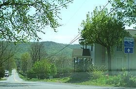
Elevation 1,673 ft (510 m) Topo map USGS Tablers Station Parent range Appalachian Mountains | Prominence 1,073 ft (327 m) Easiest route Drive | |
 | ||
Location | ||
North Mountain is a mountain ridge within the Ridge-and-valley Appalachians in the U.S. states of Virginia and West Virginia.
Contents
- Map of North Mountain Valley WV 25403 USA
- GeographyEdit
- Variant namesEdit
- Summits knobs and gapsEdit
- References
Map of North Mountain, Valley, WV 25403, USA
GeographyEdit
North Mountain spans 23.5 miles (37.8 km) from the Potomac River in the north to the community of Green Spring in Frederick County, Virginia in the south. The ridge is divided into two sections; the north and south spans. The north span consists of the portion of the ridge from the Potomac to the town of Hedgesville, West Virginia, which lies 3.5 miles (5.6 km) to the south within Skinners Gap in between the mountain's two spans. The northern span is characterized by lower elevations, its highest point is 920 feet (280 m) just north of Hedgesville, and numerous gaps at valley floor elevations. The southern span consists of the remaining 20 miles (32 km) of ridge line and is noticeably higher in elevation, containing the mountain's highest point of 1,673 feet (510 m) above sea-level at its Roundtop summit near Arden in Berkeley County, West Virginia. The southern section also contains many gaps, but all are several hundred feet above the valley floor. Back Creek Valley lies to the mountain ridge's west and the Shenandoah Valley to its east. Back Creek owes its name to North Mountain, as early settlers in the eighteenth century referred to the stream as to the "back" of the ridge when approaching it from the east.
Variant namesEdit
According to the Geographic Names Information System, North Mountain has also widely been known as Great Ridge and Little North Mountain, when in comparison to the much larger Great North Mountain to the south.
Summits, knobs and gapsEdit
Although North Mountain is a continuous mountain ridge, it is made up of a number of summits, knobs and gaps with individual names. These are listed from north to south.
