
Country United States Area code(s) 401 Local time Friday 1:04 PM | Time zone Eastern (EST) (UTC-5) Elevation 25 m Population 26,197 (2015) | |
 | ||
Weather 3°C, Wind SE at 26 km/h, 86% Humidity Neighborhoods Annaquatucket, Wickford | ||
Colonial waterview home in north kingstown rhode island
North Kingstown is a town in Washington County, Rhode Island, United States, and is part of the Providence metropolitan area. As of the United States Estimated Population 2013, the population was 35,320 making it the 13th largest municipality in the state. North Kingstown is home to the birthplace of the famous American portraitist Gilbert Stuart who was born in the village of Saunderstown. Within the town is Quonset Point, location of the former Naval Air Station Quonset Point, known for the invention of the Quonset hut, as well as the neighborhood of Davisville, location of the former Davisville Naval Construction Battalion Center.
Contents
- Colonial waterview home in north kingstown rhode island
- Map of North Kingstown RI USA
- Crafting a town s energy plan north kingstown rhode island
- History
- Geography
- Demographics
- Transportation
- Notable people
- Points of interest
- Other National Historic Places in North Kingstown
- References
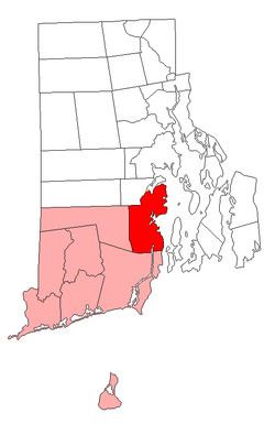
Map of North Kingstown, RI, USA
Crafting a town s energy plan north kingstown rhode island
History
The town of Kings Towne was founded in 1674, by the colonial government, and included the present day towns of North Kingstown, South Kingstown, Exeter, and Narragansett. In 1722, Kings Towne was split into two parts, North Kingstown and South Kingstown, with North Kingstown, having the earliest settlements, retaining the 1674 establishment date. In 1742 the town of Exeter was taken from the western part of North Kingstown.
Geography
According to the United States Census Bureau, the town has a total area of 58.3 square miles (151 km2). 43.6 square miles (113 km2) of it is land and 14.8 square miles (38 km2) of it (25.28%) is water.
Demographics
As of the census of 2000, there were 26,326 people, 10,154 households, and 7,310 families residing in the town. The population density was 603.9 people per square mile (233.2/km²). There were 10,743 housing units at an average density of 246.4 per square mile (95.2/km²). The racial makeup of the town was 95.71% White, 0.97% African American, 0.55% Native American, 0.95% Asian, 0.03% Pacific Islander, 0.53% from other races, and 1.25% from two or more races. Hispanic or Latino of any race were 1.77% of the population.
There were 10,154 households out of which 35.7% had children under the age of 18 living with them, 40.6% were married couples living together, 46.5% had a female householder with no husband present, and 28.0% were non-families. 22.5% of all households were made up of individuals and 8.2% had someone living alone who was 65 years of age or older. The average household size was 2.57 and the average family size was 3.03.
In the town, the age distribution of the population shows 26.0% under the age of 18, 6.0% from 18 to 24, 29.6% from 25 to 44, 26.6% from 45 to 64, and 11.8% who were 65 years of age or older. The median age was 39 years. For every 100 females there were 93.9 males. For every 100 females age 18 and over, there were 89.6 males.
The median income for a household in the town was $83,887 (adjusted to inflation), and the median income for a family was $97,208. Males had a median income of $28,883 versus $25,712 for females. The per capita income for the town was $39,324. About 18.8% of families and 16.1% of the population were below the poverty line, including 9.6% of those under age 18 and 4.8% of those age 65 or over.
Transportation
Wickford Junction is a terminus station on the Providence/Stoughton Commuter Rail Line, providing weekday service to Providence Station and Boston's South Station.
RIPTA also services in the town inbound to Providence and outbound to Narragansett or Newport