
Width 23 km (14.3 mi) Elevation 600 m | Length 42 km (26.1 mi) Highest elevation 600 m (2,000 ft) Area 590 km² | |
 | ||
Island groups Canadian Arctic Archipelago, Queen Elizabeth Islands | ||
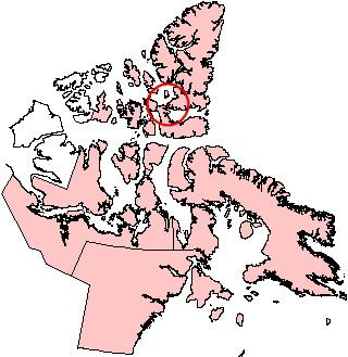
North Kent Island is one of the uninhabited Canadian arctic islands in the Qikiqtaaluk Region of Nunavut, Canada. It is located in the Cardigan Strait between Devon Island's Colin Archer Peninsula and Ellesmere Island's Simmons Peninsula.
Contents
Map of North Kent Island, Baffin, Unorganized, NU, Canada
Geography
The 590 km2 (230 sq mi) island's terrain is flat-topped and ice-capped, with steep cliffs.
Fauna
North Kent Island is a Canadian Important Bird Area (#NU052), and an International Biological Program site. Notable bird species include black guillemot, common eider, glaucous gull, and Thayer's gull.
Walrus, bearded seal, ringed seal, and narwhal frequent the area.
References
North Kent Island Wikipedia(Text) CC BY-SA