
Basin area 12,950 km² Country United States of America | Length 436 km | |
 | ||
Main source Gray County, Texas3,471 ft (1,058 m) River mouth Tillman County, Oklahoma1,181 ft (360 m) Basin size 5,000 sq mi (13,000 km) | ||
North fork red river bird sayre oklahoma storm chase 16may15 440p
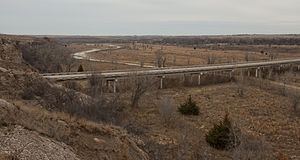
The North Fork Red River, sometimes called simply the "North Fork", is a tributary of the Red River about 271 mi (436 km) long, heading along the eastern Caprock Escarpment of the Llano Estacado about 11.4 mi (18.3 km) southwest of Pampa, Texas. Rising in Gray County, Texas, it terminates at the confluence with Prairie Dog Town Fork of the Red River at the Texas-Oklahoma border.
Contents
- North fork red river bird sayre oklahoma storm chase 16may15 440p
- Map of North Fork Red River Oklahoma USA
- Course
- Historic significance
- References
Map of North Fork Red River, Oklahoma, USA
Course
From its source in central Gray County, Texas, the river flows eastward, passing through Wheeler County, Texas, into Oklahoma. Just west of the Wheeler county line, it is joined by McClellan Creek, its chief tributary. In Oklahoma, the stream flows east across Beckham County where it is joined by Sweetwater Creek. It then turns southeast to form the county line between Greer and Kiowa counties, where it is impounded to form Lake Altus-Lugert. In southern Greer County, the North Fork joins Elm Creek before turning in a more southerly direction, forming the border between Kiowa County and Jackson County, Oklahoma and Jackson County, and Tillman counties. It joins the Prairie Dog Town Fork of the Red River at the Texas-Oklahoma border about 12.7 mi (20.4 km) northeast of Vernon, Texas. Overall, the North Fork descends 2,098 ft (639 m) from its headwaters to its confluence with the Red River, passing through mostly rolling to flat terrain with local shallow depressions along its course.
Historic significance
After the Adams-Onis Treaty defined the Red River as the boundary between the United States and New Spain in 1819, the North Fork was considered to be part of the boundary. The Marcy Expedition in 1852 discovered that the main channel of the Red River was actually the South Fork of the Red River, now named Prairie Dog Town Fork of the Red River. The U. S. government thereafter claimed the land between the two Red River streams as far as the 100th Meridian as part of its own territory. After the Republic of Texas joined the United States, Texas still claimed the area, which it named Greer County). A lawsuit brought by Texas against the United States was litigated before the United States Supreme Court, was won by the United States. As a result, Greer County, Texas became a part of Oklahoma Territory and the North Fork ceased to be the Texas boundary.