
Length 53.6 km | ||
 | ||
Counties | ||
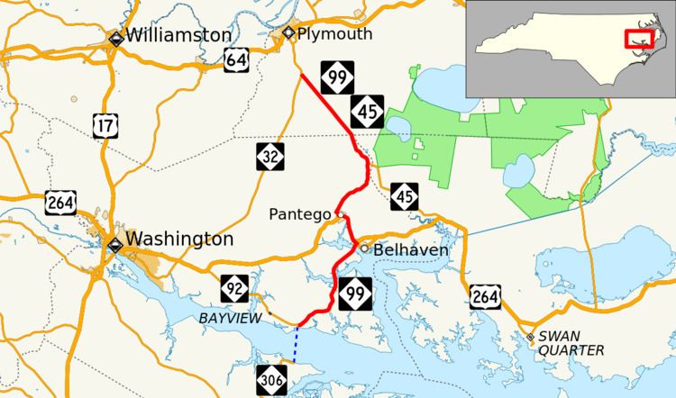
North Carolina Highway 99 (NC 99) is a North Carolina state highway in the central Coastal Plain region of the state. It is 33 miles (53 km) long and is signed north/south.
Contents
Map of NC-99, North Carolina, USA
History
NC 99 was created in the early-1930s, being routed over a previously unnumbered road in Beaufort County. The road ran north from U.S. Route 264 (US 264) to a modern-day secondary road (which, at that time, was the first incarnation of NC 97).
Around the late-1930s, the highway's current alignment began to take shape. The original NC 99 was reassigned as an extension of NC 32, and NC 99 was given its current assignment as a state highway through Washington County and Beaufort County. The southern terminus was originally at US 264 in Pantego, North Carolina.
In the mid-1980s, NC 99 was extended along US 264 and the former NC 92 to its current southern terminus in Bayview, North Carolina, (at NC 306). By this time, the northernmost few miles of NC 99 had been concurrent with NC 45. These two highways divide in Union Grove, and NC 45 continues southward to US 264 in Hyde County.