
Existed: 1930 – present Constructed 1930 | Length 118.3 km | |
 | ||
Touristroutes: Alligator River Route Edenton-Windsor Loop Counties | ||
North Carolina Highway 94 (NC 94) is a north–south North Carolina highway running for approximately seventy-three and a half miles (118.3 km) from southern Chowan County to Swan Quarter in Hyde County.
Contents
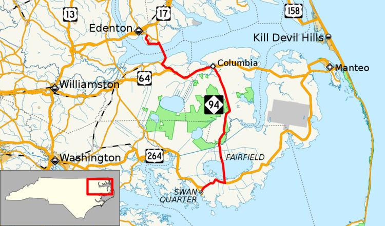
Map of NC-94, North Carolina, USA
Route description
The route spans the Albemarle Sound at the 3.5-mile (5.6 km) Albemarle Sound Bridge, connecting Chowan and Washington counties. It also crosses Lake Mattamuskeet at the Mattamuskeet National Wildlife Refuge. The highway passes through the following municipalities:
History
NC 94 was established in 1930 as a new primary spur routing from NC 91, in Swindell Fork, to Fairfield. In 1931, NC 94 was extended north on new primary routing to NC 90, in Columbia. In 1935, NC 94's southern terminus was rerouted to US 264, in Rose Bay; the reroute was a swap with NC 6. In 1942, NC 94 was rerouted at Fairfield onto new primary routing directly south through Lake Mattamuskeet. The nearly six-mile (9.7 km) causeway connects directly with US 264 near New Holland; the former alignment that went around the western banks of Lake Mattamuskeet were downgraded to secondary roads (Piney Woods Road (SR 1305) and Turnpike Road (SR 1304)).
In 2000, NC 94 was extended both directions: At Lake Comfort, it goes west on a 7-mile (11 km) concurrency with US 264 to Swain Quarter, where it then splits off onto Main Street and continues till it reaches NC 45, its current southern terminus. At Columbia, NC 94 goes west on a 17-mile (27 km) concurrency with US 64 near Pea Ridge, where it then switches concurrences with NC 32. Traveling north, it crosses over the Albemarle Sound, then separates from NC 32 near St. Johns. On Soundside Road, it connects with Northeastern Regional Airport before reconnecting with NC 32 near Edenton and its current northern terminus. In 2003, US 64 was rerouted onto new primary routing through Washington County and part of Tyrrell County, leaving NC 94 continuing along its former alignment.