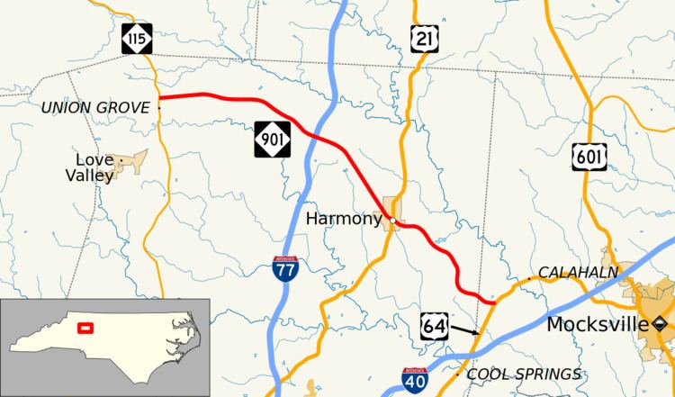
Existed: 1930 – present North end: NC 115 near New Hope Constructed 1930 | South end: US 64 near Calahaln Length 30.6 km | |
 | ||
Counties | ||
North Carolina Highway 901 (NC 901) is a primary state highway in the U.S. state of North Carolina. The highway serves to connect the town of Harmony with nearby major highways.
Contents
Map of NC-901, North Carolina, USA
Route description
NC 901 is a two-lane rural highway that traverses 19.0 miles (30.6 km) from US 64, near Calahaln, to NC 115, near New Hope. Surrounded most of its journey with farmland, NC 901 is a no-thrills road through northern Iredell County.
NC 901 is a viable alternate route between Mocksville and Wilkesboro; it is shorter in mileage, though takes a few minutes longer than via US 601 and US 421.
History
Established by 1930 as a new primary routing, from US 64/NC 90 to US 21/NC 26, in Harmony. In 1937, NC 901 was extended northwest to its current northern terminus at NC 115.
References
North Carolina Highway 901 Wikipedia(Text) CC BY-SA
