
Existed: 1941 – present Length 6.238 km | Constructed 1941 | |
 | ||
South end: SR 515 / SR 17 at the GA line County | ||
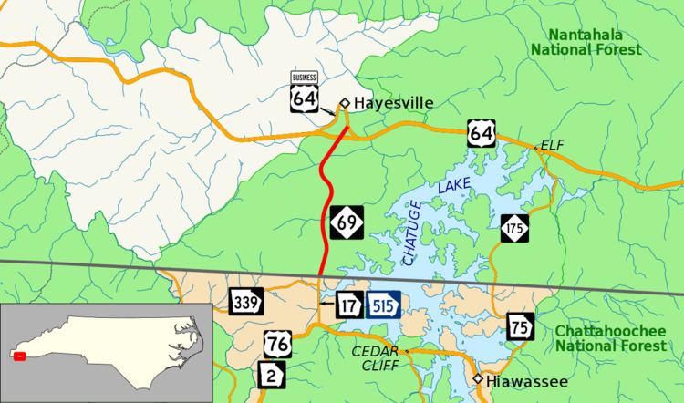
North Carolina Highway 69 (NC 69) is a primary state highway in the state of North Carolina. The highway runs north–south from the Georgia state line to Hayesville, west of Chatuge Lake.
Contents
- Map of NC 69 Hayesville NC 28904 USA
- Route description
- History
- North Carolina Highway 287
- Future
- Junction list
- ArdenAsheville alternate route
- References
Map of NC-69, Hayesville, NC 28904, USA
Route description
NC 69 runs from the Georgia border south of Hayesville and along the western shore of Chatuge Lake. The route crosses U.S. Route 64 (US 64) before entering downtown Hayesville, where it meets its northern terminus at a roundabout with US 64 Bus.
NC 69 is also part of Corridor A, in the Appalachian Development Highway System (ADHS), which is part of Appalachian Regional Commission (ARC).
History
The second and current NC 69 was established in 1941 as a renumbering of NC 287, traversing from Georgia state line, along Myers Chapel Road, to US 64 (Chatuga Dam Road), south of Hayesville. In 1942, NC 69 was rerouted to its current alignment west of its former, most of which now under Chatuge Lake.
The first NC 69 was an original state highway that began at NC 20, in Marshall, to NC 26, in Twin Oaks. Its routing took NC 69 through Burnsville, Spruce Pine, Cranberry, Banner Elk, Boone and West Jefferson. In 1928, NC 69 was extended south to the South Carolina state line, in concurrency with US 25, taking it through Asheville, Arden and Hendersonville; this replaced most of NC 29 and its old routing to Marshall became NC 213. In 1930, NC 69 was rerouted at Cranberry towards Elk Park and the Tennessee state line, in concurrency with US 19E; its old alignment north was broken up with NC 194 between Cranberry and Villas, NC 60 between Villas and Boone, and NC 691 between Boone Twin Oaks. In 1932, NC 69 was placed on new routing between Arden and Asheville, its old alignment became NC 69A, though remained part of US 25. In 1934, NC 69 was decommissioned in favor of US 25, US 19 and US 19E.
North Carolina Highway 287
North Carolina Highway 287 (NC 287) was established in 1923 as a renumbering of part of NC 109. It traversed from the Georgia state line (along Myers Chapel Road) to NC 28 (Chatuga Dam Road), near Hayesville. In 1941, NC 287 was renumbered to NC 69.
Future
NCDOT plans to upgrade NC 69 into a divided four-lane expressway, from the Georgia state line to US 64; which would complete a gap in Corridor A. At an estimated cost of $43.7 million, it is currently unfunded.
Junction list
The entire route is in Clay County.
Arden–Asheville alternate route
North Carolina Highway 69 Alternate (NC 69A) was a renumbering of NC 69 between Arden and Asheville, connecting the communities of Skyland and Biltmore; it was in complete concurrency with US 25. In 1934, NC 69A was decommissioned in favor of US 25.