
Existed: 1930 – present Constructed 1930 | Length 3.4 km | |
 | ||
County | ||
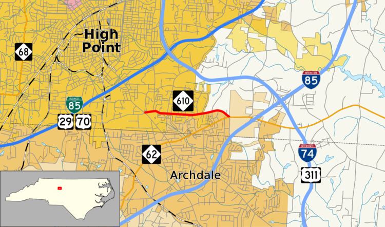
North Carolina Highway 610 (NC 610) is a primary state highway in the U.S. state of North Carolina. The highway connects Main Street in southern High Point with North Carolina Highway 62 east of Archdale. The highway provides indirect access between High Point and Interstate 85/Interstate 74. The current highway was established in 1930 and its routing has remained unchanged since.
Contents
Map of NC-610, High Point, NC 27263, USA
Route description
NC 610 is a connector route that establishes a link between Main Street (formerly US 311) and NC 62 near the downtown area of Archdale. The highway begins along a commercial area of Main Street, approximately 1 mile north of the center of Archdale. The highway runs east along Fairfield Road, through a residential area of southern High Point. In addition to multiple houses, the highway passes by a Prep Academy, along with several small businesses and a Wesleyan Church. NC 610 ends at an intersection with NC 62 (Liberty Road) and Aldridge Road, near I-85.
History
NC 610 was established in 1930 as a connector route running from US 311/NC 77 to its parent route NC 61, following its present-day routing. By 1940, NC 61 was replaced with NC 62 forming the current eastern terminus of the highway. On September 8, 2011, US 311 was deleted along Main Street and placed along a new freeway concurrently with I-74. This left the western terminus of NC 610 without an official highway designation.
Junction list
The entire route is in Guilford County.