
Length 8.158 km | ||
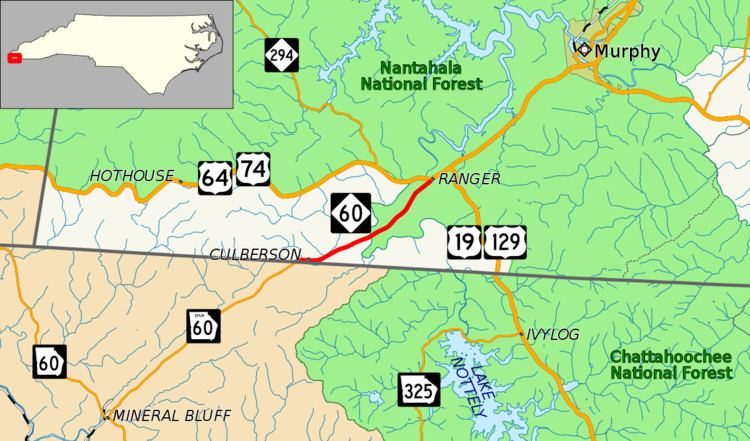 | ||
South end: SR 60 Spur at the GA line North end: US 64 / US 74 near Ranger County | ||
North Carolina Highway 60 (NC 60) is a primary state highway in the extreme southwestern corner of North Carolina. The highway runs north–south from the Georgia state line to U.S. Route 64/U.S. Route 74 (US 64/US 74), near Ranger.
Contents
Map of NC-60, Murphy, NC 28906, USA
Route description
NC 60 is a continuation of SR 60 Spur. From the Georgia state line to US 64/US 74, the entire route is four-lane with a center turning lane throughout (though the road in Georgia is only two-lanes wide). It also serves to connect the community of Culberson, which lays close to the state line.
History
The first NC 60 was an original state highway, traveling from the Tennessee state line, near Zionville, to NC 40, in Castle Hayne. It served as a major route through the state, passing through Boone, Wilkesboro, Winston-Salem, Greensboro, Sanford and Clinton. In 1934, the route was decommissioned in favor of US 421.
The current alignment of NC 60 was established in 1934 as a renumbering of a part of NC 294 traveling as it does today. The only difference is that it continued into Georgia as SR 86 before being renumbered SR 60 Spur. In 2000, the highway was widened to four-lane with a center turning lane throughout.
Junction list
The entire route is in Cherokee County.