
Existed: 1934 – present Constructed 1934 | Length 86.1 km | |
 | ||
Counties | ||
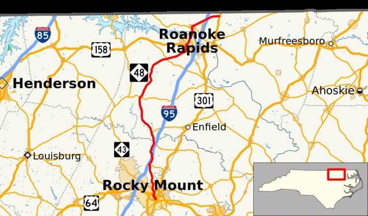
North Carolina Highway 48 (NC 48) is a state highway in the North Carolina Highway System that principally connects the cities of Rocky Mount and Roanoke Rapids. The route offers an alternative to US 301 and I-95.
Contents
Map of NC-48, North Carolina, USA
Route description
The highway runs from the community of Pleasant Hill, just south of the North Carolina/Virginia border, south through the Hickory Crossroads area and into downtown Rocky Mount. Approximately half the route's length is shared with NC 4.
History
The second and current NC 48 was established in 1934 as a renumbering of NC 482, which traversed between NC 43, in Rocky Mount, and US 158, in Littleton. In 1952, NC 48 was rerouted at Brinkleyville northeasterly on new primary routing to Roanoke Rapids, then replaced NC 47 through Gaston and Pleasant Hill; its former alignment became parts of NC 561, Old NC 48 (SR 1312) and NC 4. Between 1963-1968, NC 48 was extended south, with NC 43, to US 301 Bus. In 1998, NC 48, with NC 43, were rerouted on new connector on Peachtree Street.