
Existed: 1928 – present Constructed 1928 | Length 227.1 km | |
 | ||
Counties Craven County, North Carolina | ||
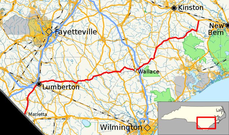
North Carolina Highway 41 (NC 41) is a primary state highway in the U.S. state of North Carolina. The highway travels in a north–south orientation between the South Carolina state line to Lumberton, then switches to an east–west orientation connecting the cities and towns of Elizabethtown, White Lake, Harrells, Wallace, Beulaville and Trenton.
Contents
Map of NC-41, North Carolina, USA
Future
A request was submitted by NCDOT Division 6 to restore NC 41 on its old alignment through Elizabethtown, via NC 87 Bus. Justification for the request was when it was rerouted in 1998, no signage and other NCDOT systems were revised; this would keep NC 41 as is.
References
North Carolina Highway 41 Wikipedia(Text) CC BY-SA