
Existed: 1937 – present Counties: Sampson Constructed 1937 | Length 44.9 km | |
 | ||
County | ||
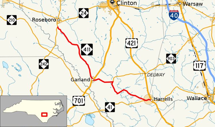
North Carolina Highway 411 (NC 411) is an east–west state highway in the U.S. state of North Carolina. The 28-mile-long (45 km) route connects the towns of Harrells, Garland, and Roseboro in the county of Sampson.
Contents
Map of NC-411, Garland, NC 28441, USA
Route description
From its eastern terminus at U.S. Route 421 (US 421) in Harrells, NC 411 travels west with NC 41 for one mile (1.6 km) before splitting on its own in a northwesterly direction. Passing through rural Sampson County on a road with the street name Harrells Highway, NC 411 passes the southern terminus of NC 903 and enters the town of Garland. In the center of Garland, NC 411 crosses US 701 before continuing northeast on a path toward Roseboro. Just south of Roseboro, NC 411 ends at NC 242.
History
NC 411 was first commissioned in 1937, starting as a short route between Harrells and Garland. Its eastern terminus was at the former alignment of NC 41 and the western terminus was at US 701. In the early 1950s the routing of NC 411 was extended and altered slightly to its current alignment.
Junction list
The entire route is in Sampson County.