
Existed: 1940 – present Length 33 km | Constructed 1940 | |
 | ||
Counties | ||
North Carolina Highway 35 (NC 35) is a state highway in the U.S. state of North Carolina.
Contents
Map of NC-35, North Carolina, USA
Route description
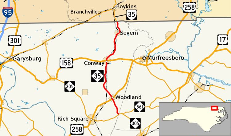
Starting from its southern terminus at NC 305/NC 561 near Tri-County Airport in Mintons Store of western Hertford County, the route immediately enters Northampton County as it progresses northward. In the town of Woodland, NC 35 joins U.S. Route 258 (US 258) as Woodland's main street, before turning north again only a couple city blocks later. The road continues north through the towns of Conway and Severn before it turns into Virginia State Route 35 at the Virginia state line. Much of the route runs mostly parallel to the North Carolina and Virginia Railroad and crosses it several times.
History
Originally, NC 35 was created around 1930 as the route that present-day NC 45 follows from US 13 to US 17. However, Virginia renumbered its routes in 1940, and North Carolina followed suit to remain consistent.