
Country United States Time zone Eastern (EST) (UTC-5) Area 3.3 km² Population 766 (2013) | Elevation 69 ft (21 m) Area code(s) 252 Zip code 27897 | |
 | ||
Weather 19°C, Wind NW at 6 km/h, 62% Humidity | ||
Woodland is a town in Northampton County, North Carolina, United States. The population was 809 at the 2010 census. It is part of the Roanoke Rapids, North Carolina Micropolitan Statistical Area.
Contents
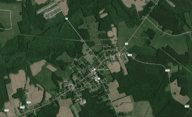
Map of Woodland, NC, USA
History
The Woodland-Olney School was listed on the National Register of Historic Places in 1997.
Geography
Woodland is located at 36°19′45″N 77°13′2″W (36.329052, -77.217250).
According to the United States Census Bureau, the town has a total area of 1.3 square miles (3.4 km2), all of it land.
Demographics
As of the census of 2000, there were 833 people, 328 households, and 211 families residing in the town. The population density was 644.6 people per square mile (249.3/km²). There were 356 housing units at an average density of 275.5 per square mile (106.6/km²). The racial makeup of the town was 51.02% White, 47.78% African American, 0.48% Native American, 0.60% from other races, and 0.12% from two or more races. Hispanic or Latino of any race were 0.96% of the population.
There were 328 households out of which 28.7% had children under the age of 18 living with them, 39.6% were married couples living together, 22.9% had a female householder with no husband present, and 35.4% were non-families. 32.3% of all households were made up of individuals and 16.2% had someone living alone who was 65 years of age or older. The average household size was 2.52 and the average family size was 3.19.
In the town, the population was spread out with 31.5% under the age of 18, 7.0% from 18 to 24, 21.5% from 25 to 44, 23.4% from 45 to 64, and 16.7% who were 65 years of age or older. The median age was 35 years. For every 100 females there were 77.2 males. For every 100 females age 18 and over, there were 71.5 males.
The median income for a household in the town was $22,125, and the median income for a family was $30,804. Males had a median income of $28,438 versus $23,125 for females. The per capita income for the town was $12,682. About 21.4% of families and 28.1% of the population were below the poverty line, including 40.4% of those under age 18 and 27.3% of those age 65 or over.
Politics
Woodland is in the first congressional district of North Carolina, and since 2004 is represented in Congress by G. K. Butterfield. It is within the traditionally Democratic county of Northampton which was one of only two counties in the state won by George McGovern.
Opposition to solar energy
In 2015, the Woodland town council imposed a moratorium on solar energy farms after three solar farms were approved. At the town council meeting where the issue was discussed, fear was expressed that proposed installation of additional solar panels would prevent plants in the area from photosynthesizing, stopping them from growing. Resident Jane Mann, a retired science teacher, expressed concern for the natural vegetation that makes the community beautiful, explaining that she had observed areas near solar panels where vegetation was dead due to lack of enough sunlight. She also stated that solar panels could cause cancer. Bobby Mann argued that additional solar farms would “suck up all the energy from the sun” and hurt the town’s businesses. Another resident asked that any future solar farm requests be placed on a referendum so the citizens can make the decision.