
Existed: 1932 – present Length 28.6 km | Counties: Columbus Constructed 1932 | |
 | ||
County | ||
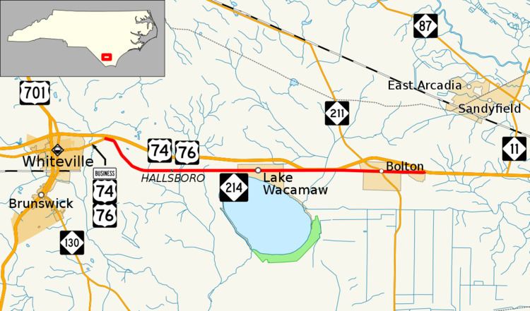
North Carolina Highway 214 (NC 214) is an east–west state highway in eastern North Carolina; it is entirely in Columbus County.
Contents
Map of NC-214, North Carolina, USA
Route description
NC 214 begins at an intersection with Business U.S. Routes 74 and 76 about one and a half miles (2.4 km) east of Whiteville. The intersection is located just south of exit 244 on U.S. Route 74 (US 74) and US 76. The two-lane road heads southeast then due east through a rural area until reaching the communities of Hallsboro and Artesia. NC 214 heads north of Lake Waccamaw and the town of the same name. Though the road never strays more than one mile (1.6 km) from the US 74/US 76 freeway throughout its entire length, the freeway dips south to cross the Friar Swamp/Green Swamp immediately adjacent to the lanes of NC 214. After heading through the town of Bolton where it intersects NC 211, the road briefly widens from a two-lane road to a four-lane divided highway but soon ends at an intersection with US 74/US 76 one mile (1.6 km) east of the town.
History
In the 1930s, NC 214 was made as a highway through Lake Waccamaw off of US 74 and NC 20. In the 1980s, it was rerouted so that NC 20 was now NC 214, and US 74 was on another highway. However, it was shorter than it is now; it was later extended to the east and west. The original NC 214 is now Lake Shore Drive.
Junction list
The entire route is in Columbus County.