
Country United States ZIP code 28442 Area 8.45 km² Population 465 (2010) | Time zone Eastern (EST) (UTC-5) Area code(s) 910 Elevation 20 m Local time Wednesday 3:15 AM | |
 | ||
Weather 1°C, Wind NW at 18 km/h, 42% Humidity | ||
Hallsboro is an unincorporated community and census-designated place (CDP) in Columbus County, North Carolina, United States. As of the 2010 census it had a population of 465.
Contents
- Map of Hallsboro NC 28442 USA
- Crime rates
- Education
- Geography
- Local parks and attractions
- Born in Hallsboro
- References
Map of Hallsboro, NC 28442, USA
Crime rates
Because there are no specific crime rates for the town of Hallsboro, the data was taken from Columbus County.
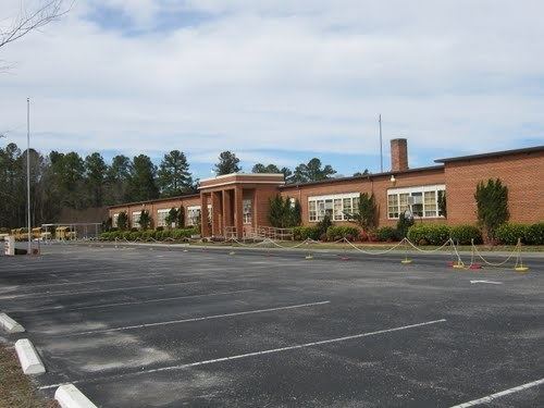
Education
There is an elementary school and middle school in Hallsboro. There is no high school in Hallsboro; the students attend East Columbus High School at Lake Waccamaw. There are no libraries in Hallsboro; the closest is the Rube McCray Memorial Library 5.3 miles (8.5 km) away at Lake Waccamaw.
Geography
Hallsboro is located in east-central Columbus County at 34°19′21″N 78°35′56″W (34.322391, -78.598902). It lies 66 feet (20 m) above sea level. The town is in the Eastern Time Zone (EST/EDT) and observes daylight saving time.
According to the U.S. Census Bureau, the Hallsboro CDP has an area of 3.3 square miles (8.5 km2), all of it land.
Surrounding communities include Lake Waccamaw 5 miles (8 km) to the east, Whiteville, the Columbus County seat, 6 miles (10 km) to the west, Bolton 11 miles (18 km) to the east, and Clarkton 13 miles (21 km) to the north.
Local parks and attractions
Lake Waccamaw State Park is located on the far side of Lake Waccamaw, 9 miles (14 km) southeast of Hallsboro.