
Existed: 1991 – present Length 5.609 km | Constructed 1991 | |
 | ||
County | ||
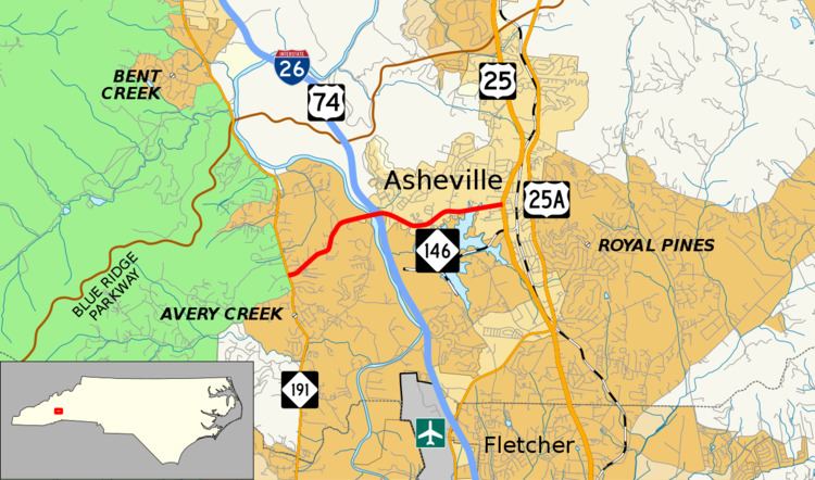
North Carolina Highway 146 (NC 146) is a short east/west state highway in western North Carolina and lies entirely in Buncombe County, south of downtown Asheville.
Contents
Map of NC-146, Arden, NC 28704, USA
Route description
NC 146 begins its western end at NC 191 in the community of Avery Creek a census-designated place (CDP) south of Asheville. NC 146 travels east and at just over 1.5 miles (2.4 km), immediately after crossing the French Broad River, intersects Interstate 26/U.S. 74 at exit 37. Passing exit 37, NC 146 enters the Asheville city limits and passes north of Lake Julian and Julian Lake Park before nearing its eastern end. At 3.51 miles (5.65 km), NC 146 reaches its eastern end at U.S. Route 25 in Skyland (but still within the Asheville city limits). It is named Long Shoals Road for its entire length.
History
The current routing of NC 146 was designated around 1991 as a renumbering of North Carolina Highway 280. NC 280 was rerouted at NC 191 to head directly east to U.S. Route 25. As a result, the former routing of NC 280 from NC 191 to Skyland became NC 146.
Major Intersections
The entire route is in Buncombe County.