
Existed: 1932 – present Constructed 1932 | Length 29.8 km | |
 | ||
Counties | ||
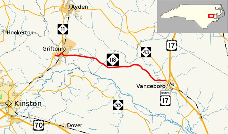
North Carolina Highway 118 (NC 118) is a primary state highway in the U.S. state of North Carolina. It runs east–west from Grifton to Vanceboro.
Contents
Map of NC-118, North Carolina, USA
Route description
A two-lane rural highway, it traverses 18.5 miles (29.8 km) through mostly farmland, as it connects the towns of Grifton and Vanceboro.
History
Established in 1932 as a new primary routing, it initially ran from U.S. Route 70 (US 70)/NC 10 (now NC 55) in Fort Barnwell, to NC 43 in Vanceboro. Around 1940, it was rerouted to a new western terminus at NC 11 in Grifton. In 1970, it was extended west over an old section of NC 11 and Grifton Hugo Road to its current western terminus of NC 11.
References
North Carolina Highway 118 Wikipedia(Text) CC BY-SA