
Founded 1760 Area 1,696 km² | Named for William Pitt the Elder Website www.pittcountync.gov Population 174,263 (2013) Unemployment rate 5.5% (Apr 2015) | |
 | ||
Colleges and Universities East Carolina University, Pitt Community College, Brody School of Medicine, Miller‑Motte College‑Greenville, Alexander Paul Institute o Points of interest Jaycee Park, Para Park, Air U Greenville Indoor Tr, GO‑Science, Dream Park | ||
Pitt County is a county located in the U.S. state of North Carolina. As of the 2010 census, the population was 168,148. Its county seat is Greenville.
Contents
- Map of Pitt County NC USA
- History
- Geography
- Adjacent counties
- Demographics
- Law and government
- Private
- Public
- Elementary schools
- K 8 schools
- Middle schools
- High schools
- Alternative schools
- Post secondary schools
- Airport
- Cities
- Census designated places
- Unincorporated communities
- References
Map of Pitt County, NC, USA
Pitt County comprises the Greenville, NC Metropolitan Statistical Area. As one of the fastest growing centers in the state, the county has seen a population boom since 1990.
History
The county was formed in 1760 from Beaufort County, though the legislative act that created it did not become effective until January 1, 1761. It was named for William Pitt the Elder, who was then Secretary of State for the Southern Department and Leader of the House of Commons. William Pitt was an English statesman and orator, born in London, England. He studied at Oxford University and in 1731 joined the army. Pitt led the young "Patriot" Whigs and in 1756 became secretary of state, where he was a pro-freedom speaker in British Colonial government.
Geography
According to the U.S. Census Bureau, the county has a total area of 655 square miles (1,700 km2), of which 652 square miles (1,690 km2) is land and 2.9 square miles (7.5 km2) (0.4%) is water.
Adjacent counties
Demographics
As of the census of 2000, there were 133,798 people, 52,539 households, and 32,258 families residing in the county. The population density was 205 people per square mile (79/km²). There were 58,408 housing units at an average density of 90 per square mile (35/km²). The racial makeup of the county was 62.08% White, 33.65% Black or African American, 0.27% Native American, 1.08% Asian, 0.04% Pacific Islander, 1.80% from other races, and 1.09% from two or more races. 3.15% of the population were Hispanic or Latino of any race.
There were 52,539 households out of which 29.90% had children under the age of 18 living with them, 43.40% were married couples living together, 14.40% had a female householder with no husband present, and 38.60% were non-families. 28.30% of all households were made up of individuals and 7.30% had someone living alone who was 65 years of age or older. The average household size was 2.43 and the average family size was 3.02.
In the county, the population was spread out with 23.60% under the age of 18, 17.50% from 18 to 24, 29.90% from 25 to 44, 19.40% from 45 to 64, and 9.60% who were 65 years of age or older. The median age was 30 years. For every 100 females there were 90.20 males. For every 100 females age 18 and over, there were 86.40 males.
The median income for a household in the county was $32,868, and the median income for a family was $43,971. Males had a median income of $31,962 versus $25,290 for females. The per capita income for the county was $18,243. About 13.50% of families and 20.30% of the population were below the poverty line, including 21.60% of those under age 18 and 20.20% of those age 65 or over.
As of the census of 2010, there were 168,148 people residing in Pitt County, a 25.7% increase since 2000. Females made up 52.8% of the population. Caucasians make up 58.9% of the population, followed by African-Americans at 34.1%, Asian persons at 1.6%, American Indian or Alaskan at 0.3%, Hispanic at 5.5%, and Native Hawaiian or Other Pacific Islander at 0.1%. From the period of 2005 to 2009, the number of foreign-born people living in the county was at 4%.
The high school graduation rate in the county among citizens over the age of twenty-five from 2005-2009 was steady at 85%, while the percentage of those aged twenty-five and up with a bachelor's degree in the county was only 28.7% in the county during the same period of time.
In 2009, the median household income in Pitt County was $36,339, over $7,000 less than the North Carolina number and about 25.5% of Pitt County residents were at or below the poverty level. The per capita money income, in terms of 2009 dollars, in the past twelve months from 2005-2009 in Pitt County was $21,622, about $3,000 less than the North Carolina average.
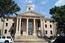
Law and government
Pitt County is a member of the Mid-East Commission regional council of governments.
Private
Private schools in Pitt County include:
Public
Public schools in Pitt County are managed by the Pitt County School District.
Elementary schools
K-8 schools
Middle schools
High schools
Alternative schools
Post-secondary schools
Airport
American Airlines (PSA Airlines) serves the Pitt-Greenville Airport daily with connecting flights to Charlotte Douglas International Airport.