
Existed: 1940 – present Length 13.7 km | Counties: Surry Constructed 1940 | |
 | ||
West end: US 52 Bus. / NC 89 in Mt. Airy East end: SR 103 at the NC/VA border County | ||
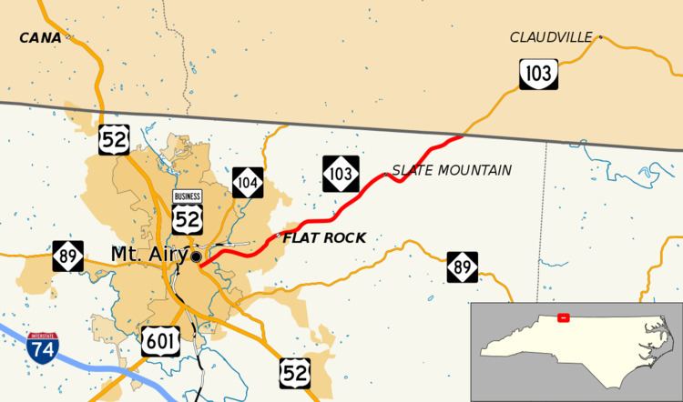
North Carolina Highway 103 (NC 103) is an 8 1⁄2-mile-long (13.7 km) North Carolina state highway. It runs entirely in Surry County. It connects the city of Mount Airy with the northern end of Surry County and Virginia State Route 103 (SR 103). A 6-mile (9.7 km) segment of the highway is known as the Donna Fargo Highway, named to honor a local country music star.
Contents
Map of NC-103, Mt Airy, NC 27030, USA
Route description
The western terminus is at NC 89 and U.S. Route 52 Business in downtown Mount Airy. This is next door to the Mount Airy Visitor Center. After traveling for about one-quarter mile (0.40 km) along East Pine Street, the highway intersects NC 104 at the latter's southern terminus. The highway travels through the community (and census-designated place) of Flat Rock before it heads into a more rural and mountainous area. It curves around Slate Mountain and passes through the community of the same name before reaching the Virginia state line. NC 103 continues into Virginia as SR 103 near Claudville.
History
The first NC 103 was today's NC 119, running mostly in Alamance and Caswell counties. It was decommissioned in 1940 and the current 103 was formed.
This was a result of Virginia's renumbering: NC 103 would supplement SR 103. There have been no other major changes made.
Junction list
The entire route is in Surry County.