North end: Admiralty Road West | Length 21.5 km | |
 | ||
History: Construction begin in 2017, completion in 2023 South end: ECP, Republic Avenue and Nicoll Highway Similar Seletar Expressway, Pan Island Expressway, East Coast Parkway | ||
North South Expressway Alignment Approved
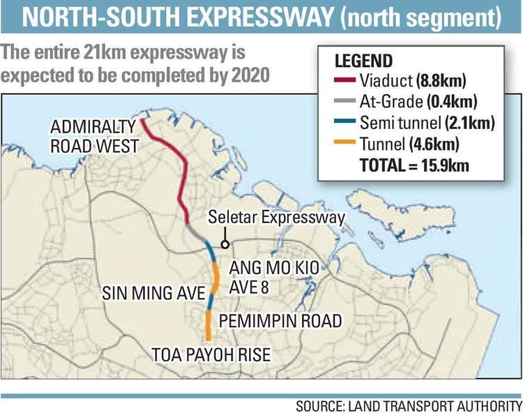
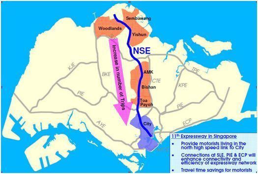
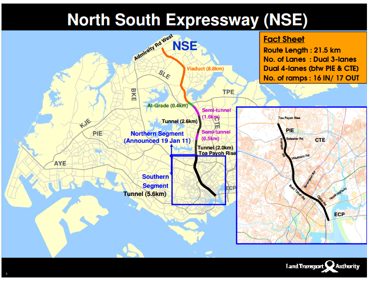
The North–South Expressway (Abbreviation: NSE) will be the 11th of Singapore's network of expressways when completed. The North South Expressway will serve increasing traffic along the north-south corridor that is currently served by the Central Expressway (CTE). This new expressway was announced on 30 January 2008 as part of a major review of Singapore's transport network by the Land Transport Authority (LTA). The 21 kilometres (13 mi) expressway would cost about S$7–8 billion when fully completed in 2023 as North-South Corridor and will connect the East Coast Parkway (ECP) with the northern parts of Singapore.
Contents
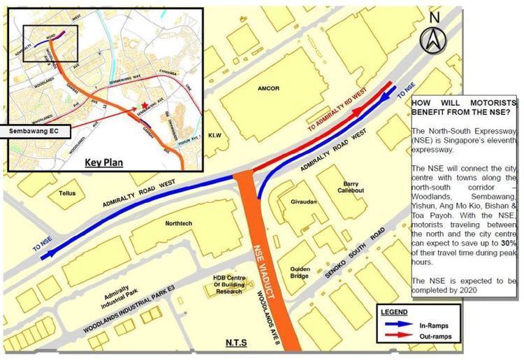
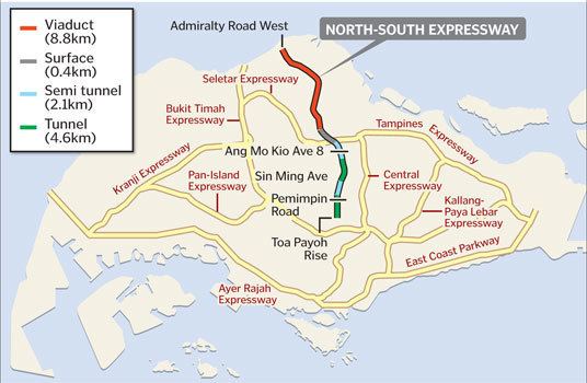
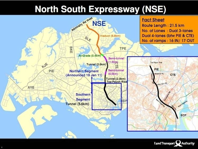
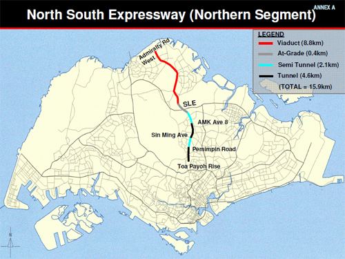
On 19 January 2011, the government gave the green light to build the expressway between Admiralty Road West and Toa Payoh Rise. On 15 November 2011, LTA unveiled the full alignment of the North-South Expressway. Construction works will commence in 2017. The North South Expressway will have a total of 16 entrances and 17 exits to connect towns along the north-south corridor—Woodlands, Sembawang, Yishun, Ang Mo Kio, Bishan and Toa Payoh—with the city centre. The NSE will also provide links to existing expressways, including the Seletar Expressway (SLE), Pan-Island Expressway (PIE) and East Coast Parkway (ECP).
Route
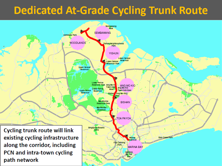
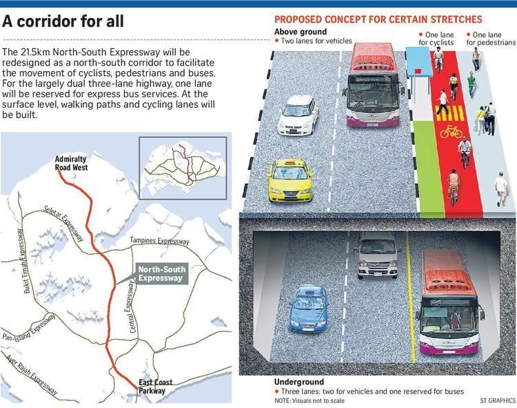
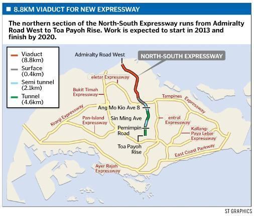
In the final plan, the NSE will commence at Admiralty Road West in northern Singapore and proceed southwards along Woodlands Avenue 8, Gambas Avenue, Sembawang Road. It will join Lentor Ave and intersect the Seletar Expressway. Major bus stops will be equipped with lift lobbies at Lentor Avenue, Ang Mo Kio Avenue 6 and Marymount Road. It will also pass through the two military training areas - Lentor and Seletar East, both of which will be cleared by 2017. It will pass Toa Payoh Rise, join Thomson Road and Bukit Timah Road running parallel to the Central Expressway. The NSE will carry on along Ophir Road, joining the East Coast Parkway at its southern terminus. In addition, there will be new bus lanes and cycling lanes.
Some land has to be acquired by the government for the project. The Land Transport Authority tried to utilize state land as far as possible, reducing the number of private properties that have to be acquired. Despite much of the expressway running underground at its southern end, some land had to be taken because of existing Mass Rapid Transit tunnels, and also because the expressway had to be straight to maintain traffic speeds. One of the prominent landmarks that has to make way for the project is the Rochor Centre. Novena Square underpasses will also be demolished, and the former Ellison Building may be considered for demolition.