
Population 5,156 (2011 census) State electorate(s) HornsbyKu-ring-gai Postal code 2076 | Postcode(s) 2076 Area 217 ha Local time Friday 8:54 PM | |
 | ||
Weather 17°C, Wind S at 13 km/h, 78% Humidity | ||
Normanhurst is a suburb located in the Upper North Shore of Sydney, in the state of New South Wales, Australia, 23 kilometres north-west of the Sydney central business district in the local government area of Hornsby Shire.
Contents
- Map of Normanhurst NSW 2076 Australia
- History
- Geography
- Commercial area
- Public transport
- Demographics
- Schools
- Churches
- Sport and recreation
- References
Map of Normanhurst NSW 2076, Australia
History
Normanhurst was originally known as Hornsby, with the suburb that is now known as Hornsby called Jack's Island. The construction of the Main Northern and North Shore railway lines in the 1890s brought about a name change. The two lines were joined at a station called Hornsby Junction, whereas the station one stop south on the Northern line kept the name Hornsby. Due to confusion around the similarly named stops, the postmaster demanded that Hornsby station change its name.
The railway station originally known as 'Hornsby', opened on 21 November 1895 and the name was changed to Normanhurst in 1900.
The first Hornsby Post Office opened on 1 August 1864 and was renamed South Hornsby in 1900 and Normanhurst in 1905.
Normanhurst was derived from the name of a prominent resident, civil engineer Norman Selfe (1839–1911), with hurst being the English word for a wooded hill. Ironically, Selfe protested against the name change. The railway station was renamed in 1900 and was used for the suburb that developed around it.
Geography
Normanhurst is divided by Pennant Hills Road, a major north-south thoroughfare that leads north to the M1 Motorway, and south towards Parramatta. However, both the east and west sections have extensive bush access. On the east side, a small section of bush lies between Normanhurst and Fox Valley. This is land occupied by the SAN Hospital. On the western side, the suburb backs onto the southern reaches of the Berowra Valley, a continuous section of bush stretching all the way to Broken Bay. This gives Normanhurst a very "leafy" and rural look, in comparison to its neighbours Hornsby, Pennant Hills and Thornleigh. This in turn contributes to making native bird life abundant. The area is home to cockatoos, rainbow lorikeets, kookaburras, noisy miners and native brush turkeys. Additionally, Normanhurst has several small waterfalls, which promote reptile life. It also has encouraged the growth of retirement residences in the suburb.
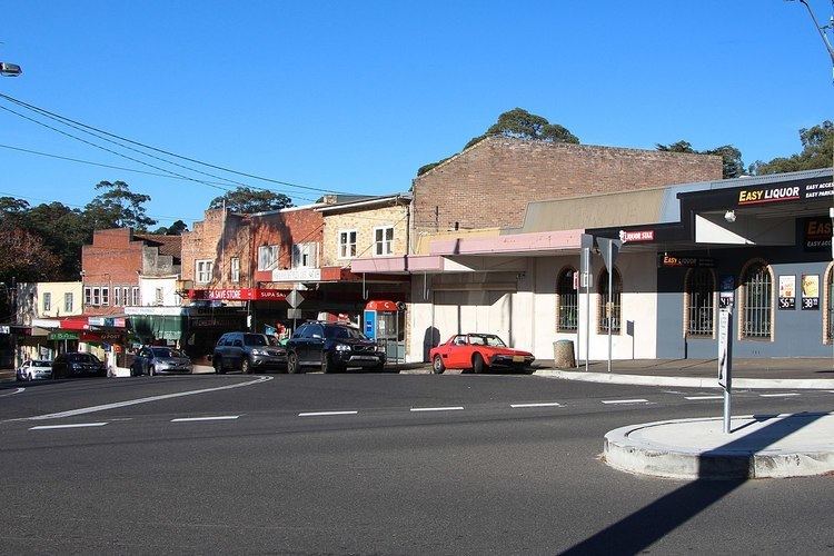
Commercial area
Normanhurst has a small number of shops close to Normanhurst railway station, which includes cafes, restaurants, a dry cleaner and an original milk bar.
Public transport
Normanhurst is serviced by rail and buses. Normanhurst railway station is on the Northern & Western Line of the Sydney Trains network.
At the 2011 census, only 25% of employed people travelled to work on public transport and 55% by car (either as driver or as passenger).
Demographics
At the 2011 census, the suburb of Normanhurst recorded a population of 5,156. Of these: