
 | ||
Curators Ronald Grim, Stephanie Cyr Headquarters Massachusetts, United States Similar Historic New England, American Antiquarian Society, Massachusetts Historical Society, American Textile History M | ||
The Norman B. Leventhal Map Center at the Boston Public Library is the steward of the Boston Public Library’s map collection, of over 200,000 historic and contemporary maps and 5,000 atlases. The Norman B. Leventhal Map Center launched in 2004 with a $10 million endowment gift as a public-private venture between the Boston Public Library (BPL) and map collector and philanthropist Norman B. Leventhal. This partnership has enabled the Norman B. Leventhal Map Center to ensure free public access to the Boston Public Library’s extraordinary cartographic collection.
Contents
Norman B. Leventhal envisioned that the Boston Public Library's cartographic collections would be the foundation of educational outreach programs for students of all ages. In support of this goal the Norman B. Leventhal Map Center maintains an interactive website, creates educational curricular materials, and exhibits that are free to the public and archived on line, for students of all ages. The library has sponsored successful exhibits relating to maps, including one in 1999 that coincided with release of the book Leventhal published, Mapping Boston, and in 2004, Faces and Places, which connected residents of Boston to their ancestral places of origin. The Norman B. Leventhal Map Center also curated an exhibit in 2006 titled "Journeys of the Imagination" which explored world maps, and most recently "Boston and Beyond: A Bird's Eye View of New England," and exhibit which looked at aerial views of New England towns.
About the Collection
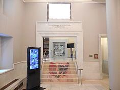
The Boston Public Library’s map collection is housed in the McKim Building of the central library in Copley Square.
The Norman B. Leventhal Map Center supports researchers and invites teachers to bring their classes to the Boston Public Library for specially planned tours of the collection.
Thousands of maps have been digitized in the Boston Public Library’s Digital Imaging Lab and added to the Norman B. Leventhal Map Center’s website, where they can be viewed using a state of the art zoom feature enabling patrons to see details on the map that would otherwise be difficult to read.
The Norman B. Leventhal Map Center's cartographic collections focus on the exploration and topographic development of New England, Massachusetts, and Boston, as well as the Golden Age of Dutch cartography. Its resources include an important and rare collection of world maps and atlases dating back to 1482, a large collection of bird’s-eye views, and a unique compilation of 18th and 19th century cartographic materials.
Portions of the Norman B. Leventhal Map Collection are on permanent exhibit and available for viewing at the Boston Harbor Hotel and the Langham Hotel in Boston, Massachusetts.
Web Portal
The center received a $40,000 grant in 2013 from the National Endowment for the Humanities for a planning project to establish protocols and agreements for creating digital access to 3,000 cartographic images, held by multiple institutions, that document the American Revolutionary War era (1750-1800).
Gallery
A small sample of maps in the collection.