
 | ||
Spitzenspiel vfl g nzburg vs tsv niederraunau 21 02 2016
Niederraunau is a quarter of the town Krumbach in Günzburg (district), Swabia, Bavaria, Germany.
Contents
- Spitzenspiel vfl g nzburg vs tsv niederraunau 21 02 2016
- Map of Niederraunau 86381 Krumbach Germany
- Cold water challenge freiwillige feuerwehr niederraunau 2014
- Geography
- History
- Sights and Attractions
- References
Map of Niederraunau, 86381 Krumbach, Germany
Cold water challenge freiwillige feuerwehr niederraunau 2014
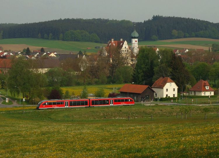
Geography
Niederraunau (Elevation 518 m) is in the valley of the little river Kammel two kilometres south of Krumbach in the natural region Lower Iller-Lech Gravel Plateau. The hills between the valleys of Kammel and the neighboring valleys of Günz and Mindel are covered with forest. Niederraunau has a station at the Mittelschwaben Railway and it is at the Bundesstraße 16.
History
Sights and Attractions
References
Niederraunau Wikipedia(Text) CC BY-SA