
Area 1,334 km² Capital Nicoya | Founded 7 December 1848 Population 52,606 (Jun 2013) | |
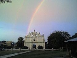 | ||
Nicoya is the second canton in the province of Guanacaste in Costa Rica. The canton covers an area of 1,333.68 km², and has a population of 52,606. Its capital city is also called Nicoya.
Contents
The Río Tempisque establishes the northeast boundary of the canton, which cuts through the midsection of the Nicoya Peninsula, touching the Gulf of Nicoya on the east before curving southward to the Pacific Ocean.
Districts
The canton of Nicoya is subdivided into seven districts (distritos):
History
Nicoya was first mentioned as a canton in a decree dated December 7, 1848.
On September 5, 2012, Nicoya was struck by a magnitude 7.6 earthquake, destroying houses in the canton.
References
Nicoya (canton) Wikipedia(Text) CC BY-SA