
 | ||
Nicolás Suárez is one of the five provinces of the Bolivian Pando department and is situated in the department's northwestern parts. Its name honors Nicolás Suárez Callaú (1861-1940) who owned major parts of today's Pando and Beni Departments in the times of the caoutchouc-boom.
Contents
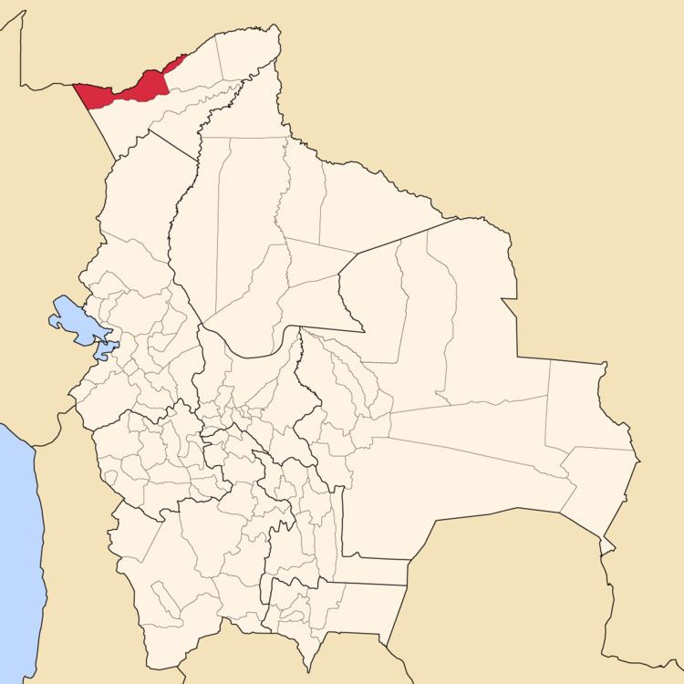
Map of Nicolas Suarez, Bolivia
Location
Nicolás Suárez Province is located between 10° 39' and 11° 27' South and between 67° 33' and 69° 34' West. It extends over a length of 370 km from Northeast to Southwest, and up to 100 km from North to South.
The province is situated in the Amazon lowlands of Bolivia and borders Brazil in the North, Peru in the West, Manuripi Province in the South, and Abuná Province in the East.
Population
The population of Nicolás Suárez Province has increased by almost 200% over the recent two decades:
The literacy rate of the province's population is 78.1%. (1992)
51.9% of the population have no access to electricity, 33.0% have no sanitary facilities. (1992)83.9% of the population are Catholics, 13.8% are Protestants. (1992)Division
The province comprises four municipalities: