
Country United States County Jessamine Time zone Eastern (EST) (UTC-5) Elevation 286 m Population 28,730 (2013) | Incorporated February 13, 1837 ZIP codes 40340, 40356 Local time Sunday 6:44 PM | |
 | ||
Weather 19°C, Wind SW at 18 km/h, 65% Humidity University Barrett and Company School of Hair Design | ||
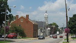
Nicholasville is a home rule-class city in Jessamine County, Kentucky, in the United States. It is the seat of its county. The population was 28,015 during the 2010 U.S. Census, making Nicholasville the 11th-largest settlement in the state.
Contents
- Map of Nicholasville KY 40356 USA
- Geography
- Climate
- History
- Government
- Education
- Demographics
- US highways
- State routes
- Future roads
- Transportation planning
- Notable people
- References
Map of Nicholasville, KY 40356, USA
Since the late 20th century, Nicholasville has undergone rapid growth; the population increased 380% between 1970 and 2010. The city serves as both a residential area for Lexington-area commuters and as an employment and shopping center for central Kentucky.
The city is home to the Kentucky Wine & Vine Fest. The annual festival showcases wines from commercial vineyards and amateur winemakers from across Kentucky and the surrounding region. In 2014 it was named as the "Official Wine Festival of Kentucky" by the Kentucky General Assembly.
Geography
Nicholasville is located at 37°52′58″N 84°34′36″W (37.882670, -84.576585). Downtown Nicholasville is approximately 6 miles (9.7 km) south of Fayette County. The city serves as a logistics and commuter hub between Lexington and Nicholasville's neighboring counties, especially Garrard County.
According to the United States Census Bureau, the city has a total area of 13.08 square miles (33.9 km2), of which 13.01 square miles (33.7 km2) is land and 0.07 square miles (0.18 km2), or 0.52%, is water. Some artificial ponds, including Lake Mingo (named after the Native American Mingo people), are present in the city. Town Fork, a partially channelized stream, runs south and passes underneath downtown, eventually draining into Jessamine Creek.
Climate
Nicholasville is in the northern periphery of the humid subtropical climate zone, with hot and humid summers, cool winters, and occasional mild periods, especially in autumn. The city and the surrounding Bluegrass region have four distinct seasons that include cool plateau breezes, moderate nights in the summer, and no prolonged periods of rain, snow, or other severe weather.
History
Nicholasville was founded in 1798. It was not formally incorporated until 1837. The town was named in honor of Colonel George Nicholas, a father of the Kentucky constitution in 1792.
The Young House in Nicholasville is listed on the National Register of Historic Places.
The city has grown rapidly since the late 20th century and is working to accommodate new highways and transportation needs. Many residents commute to Lexington; others are part of building Nicholasville as a center of retail services for the county.
Government
The Nicholasville government operates under a non-partisan City Commission. The Commission is composed of an elected mayor and four commissioners. All are elected at-large, requiring each candidate to gain the support of the majority of the electorate. The commissioners are elected to manage particular city departments. They serve two-year terms; the mayor is elected to a four-year term. The Commission wields all executive, legislative, and administrative powers.
In 2012 there was a proposal on the ballot to change the form of city government to that of a mayor-council, but it was defeated by 56% (5,004) to 44% (3,879) margin. Council members would have been elected from single-member districts, potentially broadening representation.
Commissioners draft and pass laws and, by managing their respective departments, ensure the laws are carried out efficiently. The mayor administers oaths, signs documents on the city's behalf, and conducts Commission meetings. As a member of the commission, the mayor has legislative powers equal to that of the commissioners. Commission meetings take place twice monthly.
Education
Nicholasville has an elementary school and is served by county middle and high schools. There are fourteen schools in Jessamine County. There are two high schools, East Jessamine High School and West Jessamine High School. There are two middle schools in Jessamine County, which are East Jessamine Middle School and West Jessamine Middle School. The six elementary schools in Jessamine County include the following: Brookside Elementary School, Nicholasville Elementary School, Rosenwald-Dunbar Elementary School, Warner Elementary School, Wilmore Elementary School, and Red Oak Elementary.
Demographics
As of the 2010 census, there were 28,015 people, 10,492 households, and 7,503 families residing in the city. The population density was 2,141.9 per square mile (827.0/km2). There were 11,405 housing units at an average density of 872.0 per square mile (336.7/km2). The racial makeup of the city was 91.5% White (89.5% non-Hispanic), 4.3% African American, 0.2% Native American, 0.5% Asian, 0.1% Pacific Islander, 1.2% from other races, and 2.3% from two or more races. Hispanics or Latinos of any race were 3.5% of the population.
There were 10,492 households out of which 36.4% had children under the age of 18 living with them, 49.2% were married couples living together, 16.7% had a female householder with no husband present, 5.6% had a male householder with no wife present, and 26.5% were non-families. 22.3% of all households were made up of individuals and 7.4% had someone living alone who was 65 years of age or older. The average household size was 2.64 and the average family size was 3.07.
The age distribution was 27.9% under the age of 18, 8.8% from 18 to 24, 30.7% from 25 to 44, 22.8% from 45 to 64, and 9.8% who were 65 years of age or older. The median age was 33.1 years. For every 100 females there were 91.1 males. For every 100 females age 18 and over, there were 86.9 males.
According to Census Bureau data for 2011 (American Community Survey 5-year estimates), the median income for a household in the city was $43,453, and the median income for a family was $52,419. Full-time male workers had a median income of $37,954 versus $33,330 for females. The per capita income for the city was $19,526. About 14.5% of families and 17.1% of the population were below the poverty line, including 22.7% of those under age 18 and 6.5% of those age 65 or over.
U.S. highways
State routes
Future roads
A new 7.4-mile (11.9 km) four-lane divided highway running from a Single-point urban interchange at US 27 north of Nicholasville to US 27 south of Nicholasville is being designed to serve the eastern half of Jessamine County's county seat. The western Nicholasville bypass, signed as US 27, was completed in 1986 with an interchange at KY 29 and a few at-grade intersections.
The eastern bypass of Nicholasville will give commuters an option of bypassing the city, while serving the residents of the eastern half of Jessamine county. In September 2002, the Federal Highway Administration approved an environmental assessment document. Right-of-way purchase, estimated at $15 million, began in 2006, with relocation of utility lines in 2007 and construction in 2008. It was to be completed in 2010 at a cost of $73 million to complete. The Kentucky Transportation Cabinet predicts that when the highway opens, 58,000 travelers will use the western bypass and 45,000 will use the eastern bypass.
Transportation planning
The Lexington Area MPO is responsible for transportation planning for Fayette and Jessamine counties. This includes activities such as carpool matching, administering a commuter vanpool program, air quality forecasting, bicycle and pedestrian planning, congestion management, and developing transportation plans and documents.