
Country Thailand Time zone THA (UTC+7) Geocode 5205 Province Lampang Province | Seat Na Kae Postal code 52110 Area 1,815 km² | |
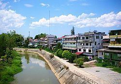 | ||
Ngao (Thai: งาว; [ŋāːw]) is a district (amphoe) of Lampang Province, northern Thailand.
Contents
Map of Ngao District, Lampang 52110, Thailand
Geography
Neighboring districts are (from the south clockwise): Mae Mo, Chae Hom and Wang Nuea of Lampang Province, Mueang Phayao and Dok Khamtai of Phayao Province, and Song of Phrae Province.
The Phi Pan Nam Mountains dominate the landscape of the district. A section of Tham Pha Thai National Park is located in Ngao District.
History
Originally named Mueang Ngao, the district was renamed to Ngao in 1938, as the prefix Mueang was then reserved for the capital districts of the provinces.
Administration
The district is subdivided into 10 subdistricts (tambon), which are further subdivided into 78 villages (muban). Hon Wang Nuea is a township (thesaban tambon) which covers the tambon Luang Nuea. There are further 9 Tambon administrative organizations (TAO).