
Country United States FIPS code 02-53820 Zip code 99559 Area code 907 | Time zone Alaska (AKST) (UTC-9) Population 354 (2010) Local time Sunday 4:05 AM Number of airports 1 | |
 | ||
Weather -15°C, Wind NE at 13 km/h, 73% Humidity Area 2.849 km² (259 ha Land / 26 ha Water) | ||
Newtok (Niugtaq in Central Alaskan Yup'ik) is a small village on the Ningliq River in western Alaska, United States. At the 2010 census the population was 354. Erosion is forcing the primarily Yupik Alaska Native village to consider relocation.
Contents
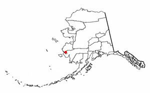
Map of Newtok, AK, USA
Geography
According to the United States Census Bureau, the CDP has a total area of 1.1 square miles (2.8 km2), of which, 1.0 square mile (2.6 km2) of it is land and 0.1 square miles (0.26 km2) of it (7.21%) is water.
Demographics
As of the census of 2000, there were 321 people, 63 households, and 51 families residing in the CDP. The population density was 313.1 people per square mile (120.3/km²). There were 67 housing units at an average density of 65.4/sq mi (25.1/km²). The racial makeup of the CDP was 3.12% White, 95.33% Native American, and 1.56% from two or more races.
There were 63 households out of which 68.3% had children under the age of 18 living with them, 63.5% were married couples living together, 11.1% had a female householder with no husband present, and 19.0% were non-families. 19.0% of all households were made up of individuals and none had someone living alone who was 65 years of age or older. The average household size was 5.10 and the average family size was 5.96.
In the CDP, the population was spread out with 45.2% under the age of 18, 10.0% from 18 to 24, 26.8% from 25 to 44, 14.3% from 45 to 64, and 3.7% who were 65 years of age or older. The median age was 21 years. For every 100 females there were 118.4 males. For every 100 females age 18 and over, there were 112.0 males.
The median income for a household in the CDP was $32,188, and the median income for a family was $32,188. Males had a median income of $26,250 versus $15,625 for females. The per capita income for the CDP was $9,514. About 29.8% of families and 31.0% of the population were below the poverty line, including 38.9% of those under age 18 and none of those age 65 or over.
Environmental issues
In 2007, The New York Times reported that erosion made Newtok an island between the widening Ningliq River and a slough to the north because Alaskan permafrost is melting due to climate change. Coastal storms and thawing permafrost have worn away the land upon which Newtok was built. According to The New York Times article, because the village is below sea-level and sinking, the town could be washed away within a decade.
Erosion of the tundra by the river has destroyed much of the area of the village, including the barge dock. The United States Army Corps of Engineers' March 2009 report estimates the highest point in the town, the high school, will be under water by the year 2017.
The town was featured in the 2009 History Channel's TV show, Tougher in Alaska, in the episode called "Dangerous Earth."
In 2015, Newtok was one of the two towns featured in the Al Jazeera English Fault Lines documentary, When the Water Took the Land. The community, who were originally nomadic, were given an ultimatum that they would have to settle in the permanent community or their children would be taken from them.
Relocation
Land has been acquired for a new townsite called Mertarvik on nearby Nelson Island about 9 miles (14 km) away, and $1 million in government funding has been obtained to build a dock for delivering building supplies.
As of 2016, although the town’s roughly 400 residents voted in 2003 to relocate to higher ground nine miles away, progress has been slow.
On December 24, 2016, the village made a disaster declaration request to the Federal Emergency Management Agency for disaster assistance due to "flooding, persistent erosion, and permafrost degradation starting in January 1, 2006 and continuing." The request would "include relocation of the Yupik Tribe (population of ~350 people)."