
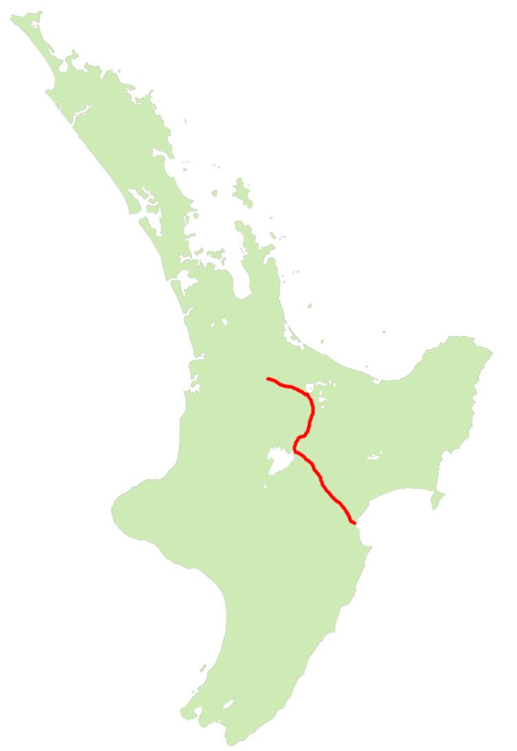
Northwest end: SH 1 at Tirau Length 262 km | Southeast end: SH 2 at Bay View | |
 | ||
Tourist
routes: Thermal Explorer Highway Primary
destinations: Rotorua, Wairakei, Taupo Highway system New Zealand state highway network Major cities Taupo, Rotorua, Wairakei, Tirau, Bay View, New Zealand | ||
State Highway 5 is the second shortest of New Zealand's eight national highways. It extends from SH 1 at Tirau, on the plains of the Waikato River, to SH 2, close to the Hawke Bay coast at Bay View, 10 km north of Napier. Distances are measured from north to south.
Contents
Map of SH 5, New Zealand
For most of its length, SH 5 is a two-lane single carriageway, other than a two-kilometre section of dual carriageway in Rotorua, with at-grade intersections and property accesses, both in rural and urban areas. The New Zealand Transport Agency classifies SH 5 as a regional strategic highway, except for the concurrent section with SH 1 through Taupo where it is classified as a national strategic road.
Route
This is the route that SH 5 takes in 2007.
Tirau to Taupo
The highway leaves SH1 at Tirau, heading east and ascending to cross the Mamaku Ranges to Lake Rotorua. The highway skirts the southwestern edge of the lake, entering the city of Rotorua and continuing south through the Rotorua-Taupo thermal area to the upper reaches of the Waikato River. It follows the river's upper valley past Wairakei and the Huka Falls to the town of Taupo, on the northeastern edge of the lake of the same name. Between Wairakei and Taupo, the highway runs concurrently with SH 1.
Taupo to Napier
From Taupo, SH 1 continues along the lake's eastern shore, while SH 5 heads southeast through the rough hill country of the Kaingaroa Forest. The highway climbs and twists past Iwitahi, crossing the headwaters of the Rangitaiki River and the watershed of the Mohaka River, before crossing the 708-metre Titiokura Saddle and heading down to the coast close to the mouth of the Esk River.
The highway passes through the small settlement of Opepe, which is at the intersection of two major pre-European walking tracks (Taupo-Napier and Urewera-Tokaanu).
Beyond Opepe lie the Kaingaroa plains, formed from the ash from the great Taupo eruption of 186 AD.
The highway next crosses the Mohaka River, the site of one of New Zealand’s major road tragedies during the 1990s, when a housebus plunged from the bridge. The Mohaka river is a popular spot for both whitewater rafting and trout fishing.
The highway next ascends to cross the Titiokura Saddle, the site of a proposed electricity generating wind farm, before passing through Te Pohue, a former coaching stop for travellers heading inland from Napier. A few kilometres further on is an unsealed road leading to Trellinoe Park, one of New Zealand’s largest private gardens.
From here, the road descends into the Esk River valley, a fertile area with vineyards and orchards, as well as one of the country’s few lavender farms, which is open to the public.
Route changes
Prior to the 1931 Hawke's Bay earthquake the road met State Highway 2 at Petane (now Bay View). The earthquake raised the land and altered the course of the Esk River; the course of the highway was changed to follow suit.
State Highway 5 once ran through central Rotorua. The old route left the current route at the Lake Road traffic lights, and followed the route of Lake Road, Ranolf Street, Amohau Street, Fenton Street, and Hemo Road, where it re-merges with the current section. Today, State Highway 5 follows Old Taupo Road, which bypasses the central city to the west.
Most recently, the Taupo Bypass was constructed shifting the original State Highway 1 from the township and lakeside to the eastern outskirts of Taupo. State Highway 5, which shares a concurrency with SH 1 from Wairakei to the Napier-Taupo Road, now also follows this route.