
North end: SH 1 at Ohaeawai Length 217 km | South end: SH 1 at Brynderwyn | |
 | ||
Primary
destinations: Dargaville, Kaikohe, Hokianga Harbour | ||
State Highway 12 (SH 12) is a New Zealand state highway in the far north of the North Island. It connects with SH 1 at both its northern and southern end. It runs close to the west coast of the Northland Region of New Zealand.
Contents
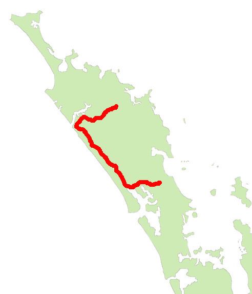
Map of State Highway 12, Northland, New Zealand
Route
SH 12 starts in Ohaeawai, running initially southwest to Kaikohe before turning roughly westwards, reaching the Hokianga harbor at its Omanaia River arm. It continues west, reaching Opononi and Omapere at the mouth of the Hokianga, before turning southeast to parallel the coast. The highway briefly follows the valley of the Waimamaku River before winding through the Waipoua Kauri Forest, then follows the valley of the Kaihu River to Dargaville. At Dargaville, the highway meets SH 14, and continues southeastwards along the edge of the Wairoa River to Ruawai before turning eastwards. It briefly skirts the edge of the Arapaoa River arm of the Kaipara Harbour before passing through Maungaturoto and ending at its junction with SH 1 at Brynderwyn, 15 km south of Waipu.