Population 434 (2011) Community New Moat Country Wales Local time Saturday 3:42 PM Post town Clarbeston | OS grid reference SN064255 Sovereign state United Kingdom | |
 | ||
Weather 15°C, Wind NE at 19 km/h, 39% Humidity | ||
New Moat (Welsh: Y Mot) is a village and community in Pembrokeshire, Wales. It extends from the southern edges of Mynydd Preseli to the Pembrokeshire-Carmarthenshire border.
Contents
Map of New Moat, Clarbeston Road, UK
Demographics
New Moat community includes the villages of New Moat, Bletherston, Llys y Fran, Henry's Moat and Penffordd, with a combined population recorded in the 2001 census of 426, increasing to 434 at the 2011 Census.
History
Historically in the hundred of Dungleddy, the village takes its name from an ancient Motte and Bailey defence of which only the artificially built mound now survives. The Black Book of St Davids 1326 records state that the Lord of New Moat paid one penny a year to the Bishops of St Davids at Castle Morris.
New Moat was once the seat of the Scourfield family, who are reported to have resided at the area since the reign of Edward I. The Scourfields provided the area of Pembrokeshire and Haverfordwest with several sheriffs and mayors, as well as Members of Parliament, including William Henry Scourfield and Sir John Scourfield. The family resided at Mote and Robertson Hall until the 19th century when the family moved to Robeston Hall in the parish of Robeston West. Mote and Robertson Hall became ruinous and has since been demolished.
Church
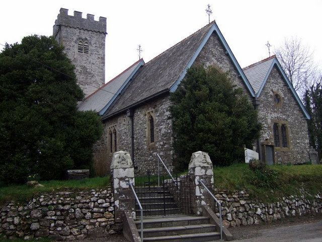
At the centre of the village is St Nicholas's church, mainly rebuilt in the 1880s, which retains its medieval tower and 17th-century altar tomb and is a grade II* listed building.
